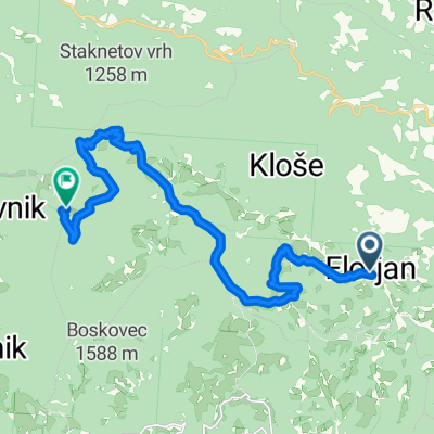
Okoli Raduhe
A cycling route starting in Topolšica, Občina Šoštanj, Slovenia.
Overview
About this route
Zahtevna pretežno hribovita trasa.
- -:--
- Duration
- 104 km
- Distance
- 1,723 m
- Ascent
- 1,725 m
- Descent
- ---
- Avg. speed
- ---
- Avg. speed
Route quality
Waytypes & surfaces along the route
Waytypes
Busy road
47.1 km
(45 %)
Road
24.4 km
(23 %)
Surfaces
Paved
23.5 km
(23 %)
Unpaved
25.1 km
(24 %)
Asphalt
23.3 km
(22 %)
Gravel
14.9 km
(14 %)
Continue with Bikemap
Use, edit, or download this cycling route
You would like to ride Okoli Raduhe or customize it for your own trip? Here is what you can do with this Bikemap route:
Free features
- Save this route as favorite or in collections
- Copy & plan your own version of this route
- Sync your route with Garmin or Wahoo
Premium features
Free trial for 3 days, or one-time payment. More about Bikemap Premium.
- Navigate this route on iOS & Android
- Export a GPX / KML file of this route
- Create your custom printout (try it for free)
- Download this route for offline navigation
Discover more Premium features.
Get Bikemap PremiumFrom our community
Other popular routes starting in Topolšica
- Topolšica
- Distance
- 34.4 km
- Ascent
- 341 m
- Descent
- 361 m
- Location
- Topolšica, Občina Šoštanj, Slovenia
- Okoli Raduhe
- Distance
- 104 km
- Ascent
- 1,723 m
- Descent
- 1,725 m
- Location
- Topolšica, Občina Šoštanj, Slovenia
- Peca_STKP
- Distance
- 66.1 km
- Ascent
- 1,801 m
- Descent
- 1,807 m
- Location
- Topolšica, Občina Šoštanj, Slovenia
- Bele vode - Uršlja gora
- Distance
- 41 km
- Ascent
- 1,291 m
- Descent
- 1,291 m
- Location
- Topolšica, Občina Šoštanj, Slovenia
- drugi dan
- Distance
- 60.7 km
- Ascent
- 903 m
- Descent
- 1,753 m
- Location
- Topolšica, Občina Šoštanj, Slovenia
- Topolšica-Smrekovec-Golte
- Distance
- 30.2 km
- Ascent
- 1,293 m
- Descent
- 255 m
- Location
- Topolšica, Občina Šoštanj, Slovenia
- Gorski triatlon Smrekovec - Tek
- Distance
- 3.4 km
- Ascent
- 589 m
- Descent
- 0 m
- Location
- Topolšica, Občina Šoštanj, Slovenia
- Vodeno doživetje, POT 3 – Po okolici Topolšice
- Distance
- 30.7 km
- Ascent
- 1,079 m
- Descent
- 1,082 m
- Location
- Topolšica, Občina Šoštanj, Slovenia
Open it in the app