

Etape XIII Jelajah Sabang - Padang # Bukittinggi - Padang
A cycling route starting in Bukittinggi, West Sumatra, Indonesia.
Overview
About this route
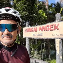
the end of a long journey ...
- -:--
- Duration
- 91.7 km
- Distance
- 269 m
- Ascent
- 1,193 m
- Descent
- ---
- Avg. speed
- ---
- Max. altitude

Continue with Bikemap
Use, edit, or download this cycling route
You would like to ride Etape XIII Jelajah Sabang - Padang # Bukittinggi - Padang or customize it for your own trip? Here is what you can do with this Bikemap route:
Free features
- Save this route as favorite or in collections
- Copy & plan your own version of this route
- Split it into stages to create a multi-day tour
- Sync your route with Garmin or Wahoo
Premium features
Free trial for 3 days, or one-time payment. More about Bikemap Premium.
- Navigate this route on iOS & Android
- Export a GPX / KML file of this route
- Create your custom printout (try it for free)
- Download this route for offline navigation
Discover more Premium features.
Get Bikemap PremiumFrom our community
Other popular routes starting in Bukittinggi
 Sumatra-Java-Bali 08, Indonesien, Bukittinggi - Maninjau, 30 km
- Distance
- 29.2 km
- Ascent
- 517 m
- Descent
- 964 m
- Location
- Bukittinggi, West Sumatra, Indonesia
 Jalan Ampang Gadang - Koto Tuo, Kabupaten Agam to Jalan Ampang Gadang - Koto Tuo, Kabupaten Agam
- Distance
- 21.8 km
- Ascent
- 187 m
- Descent
- 189 m
- Location
- Bukittinggi, West Sumatra, Indonesia
 Bukittinggi - DanguangDanguang via Batu Ampa
- Distance
- 72.8 km
- Ascent
- 333 m
- Descent
- 724 m
- Location
- Bukittinggi, West Sumatra, Indonesia
 Etape XIII Jelajah Sabang - Padang # Bukittinggi - Padang
- Distance
- 91.7 km
- Ascent
- 269 m
- Descent
- 1,193 m
- Location
- Bukittinggi, West Sumatra, Indonesia
 puncak kabun
- Distance
- 10.5 km
- Ascent
- 1,418 m
- Descent
- 901 m
- Location
- Bukittinggi, West Sumatra, Indonesia
 SFFD 2014 Bukittinggi Tour
- Distance
- 92.1 km
- Ascent
- 859 m
- Descent
- 1,793 m
- Location
- Bukittinggi, West Sumatra, Indonesia
 harau valley
- Distance
- 63.3 km
- Ascent
- 688 m
- Descent
- 942 m
- Location
- Bukittinggi, West Sumatra, Indonesia
 Jalan Panorama 19, Kecamatan Guguk Panjang to Unnamed Road, Iv Koto
- Distance
- 9.1 km
- Ascent
- 176 m
- Descent
- 122 m
- Location
- Bukittinggi, West Sumatra, Indonesia
Open it in the app