

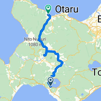
Lake Toyako to Mori
A cycling route starting in Date, Hokkaido, Japan.
Overview
About this route
some hills, some flat, lots of tunnels
- -:--
- Duration
- 117.7 km
- Distance
- 553 m
- Ascent
- 644 m
- Descent
- ---
- Avg. speed
- ---
- Max. altitude
Continue with Bikemap
Use, edit, or download this cycling route
You would like to ride Lake Toyako to Mori or customize it for your own trip? Here is what you can do with this Bikemap route:
Free features
- Save this route as favorite or in collections
- Copy & plan your own version of this route
- Split it into stages to create a multi-day tour
- Sync your route with Garmin or Wahoo
Premium features
Free trial for 3 days, or one-time payment. More about Bikemap Premium.
- Navigate this route on iOS & Android
- Export a GPX / KML file of this route
- Create your custom printout (try it for free)
- Download this route for offline navigation
Discover more Premium features.
Get Bikemap PremiumFrom our community
Other popular routes starting in Date
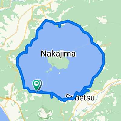
 Around Lake Toya
- Distance
- 36.1 km
- Ascent
- 153 m
- Descent
- 154 m
- Location
- Date, Hokkaido, Japan
 144-90, Toyakoonsen, Toyako, Abuta-Gun naar 144-3, Toyakoonsen, Toyako, Abuta-Gun
- Distance
- 36.9 km
- Ascent
- 200 m
- Descent
- 191 m
- Location
- Date, Hokkaido, Japan
 洞爷湖温泉, 洞爷湖町へ洞爷湖温泉, 洞爷湖町
- Distance
- 47.8 km
- Ascent
- 432 m
- Descent
- 426 m
- Location
- Date, Hokkaido, Japan
 洞爺湖到比羅夫續走余市
- Distance
- 117.6 km
- Ascent
- 923 m
- Descent
- 1,013 m
- Location
- Date, Hokkaido, Japan
 豊浦ヒルクライムチャレンジコース
- Distance
- 41.7 km
- Ascent
- 853 m
- Descent
- 857 m
- Location
- Date, Hokkaido, Japan
 Lake Toyako to Mori
- Distance
- 117.7 km
- Ascent
- 553 m
- Descent
- 644 m
- Location
- Date, Hokkaido, Japan
 上長和萩原線, Date to Hokuto
- Distance
- 265.9 km
- Ascent
- 3,461 m
- Descent
- 3,605 m
- Location
- Date, Hokkaido, Japan
 Day 4 從Pension Ohno到Hotel Inou的路線
- Distance
- 92.8 km
- Ascent
- 1,149 m
- Descent
- 1,210 m
- Location
- Date, Hokkaido, Japan
Open it in the app