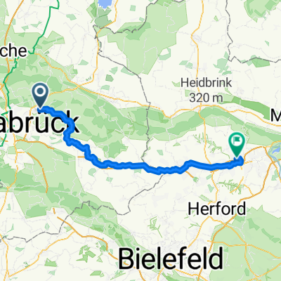
Osnabrücker Rundweg
- 49.3 km
- 276 m
- 282 m
- Belm, Lower Saxony, Germany
A cycling route starting in Belm, Lower Saxony, Germany.
Overview
We start the bike tour at the parking lot of Gattberg, initially through the "stone sea". The route takes us downhill over red earth, under the railway to federal highway 51. About 50 meters further right we cross it and continue towards the locality of Astrup. In a small forest, just a few hundred meters below the Wiehen mountain ridge, lies the "black chalk pit" of Vehrte. Passing 2 large stone graves, we go down the street into the floodplain of the "Nette", a little river that we will encounter again later. After about 2 kilometers we head towards the center of Icker. We leave Icker heading west and after a few hundred meters turn right off the main road into the lowland area of the "Nette", which we follow downstream to the west at a distance. After a while we leave the valley and cross the Rulle district of Wallenhorst. A few hills and bends later, the path leads to the "Östringer stones". Among the asphalted roads, the section that awaits us now is one of the most beautiful in the entire nature park. We enter from the south into that part of the Nette valley which has cut deeply into the surrounding rock. After about a kilometer, on the left lies "Knollmeyer's mill". Culturally interested can visit the remains of the early medieval "Wittekind castle" on the right above the road (on foot). To the north, a gravel track leads out of the Nette valley and takes us to the top of a hill, from where we have a good view of the route taken. A bumpy path through a small wood leads up the hill to the quarry "Ruller Loh". We follow the signs and reach, if we don't descend too quickly at the T-junction, a small round lake, the legendary "Icker Loch". The next kilometer again challenges our calves, but we already reach the road that leads us directly back to the parking lot.
created this 12 years ago
Route quality
Quiet road
18.1 km
(56 %)
Track
5.5 km
(17 %)
Paved
21 km
(65 %)
Unpaved
5.8 km
(18 %)
Asphalt
16.8 km
(52 %)
Paved (undefined)
4.2 km
(13 %)
Route highlights
Schwarze-Kreide-Kuhle
Teufels Teigtrog
Continue with Bikemap
You would like to ride Landpartie-Tour or customize it for your own trip? Here is what you can do with this Bikemap route:
Free trial for 3 days, or one-time payment. More about Bikemap Premium.
Discover more Premium features.
Get Bikemap PremiumFrom our community
Open it in the app