

mad mountains
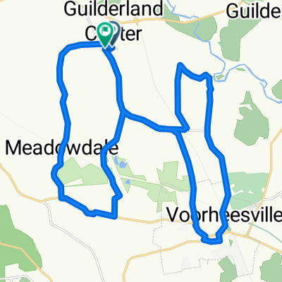
A cycling route starting in Altamont, New York, United States.
Overview
About this route
start and end at thacher. 76 miles through the mountains
- -:--
- Duration
- 123.7 km
- Distance
- 2,258 m
- Ascent
- 2,209 m
- Descent
- ---
- Avg. speed
- 811 m
- Max. altitude

Route quality
Waytypes & surfaces along the route
Waytypes
Quiet road
45.4 km
(37 %)
Busy road
40.5 km
(33 %)
Surfaces
Paved
16.7 km
(14 %)
Unpaved
1 km
(<1 %)
Asphalt
14.2 km
(11 %)
Paved (undefined)
2.6 km
(2 %)
Continue with Bikemap
Use, edit, or download this cycling route
You would like to ride mad mountains or customize it for your own trip? Here is what you can do with this Bikemap route:
Free features
- Save this route as favorite or in collections
- Copy & plan your own version of this route
- Split it into stages to create a multi-day tour
- Sync your route with Garmin or Wahoo
Premium features
Free trial for 3 days, or one-time payment. More about Bikemap Premium.
- Navigate this route on iOS & Android
- Export a GPX / KML file of this route
- Create your custom printout (try it for free)
- Download this route for offline navigation
Discover more Premium features.
Get Bikemap PremiumFrom our community
Other popular routes starting in Altamont
 8 School Rd, Altamont to 5603 NY-30, Schoharie
- Distance
- 31.3 km
- Ascent
- 457 m
- Descent
- 353 m
- Location
- Altamont, New York, United States
 Route to Altamont
- Distance
- 28.1 km
- Ascent
- 196 m
- Descent
- 194 m
- Location
- Altamont, New York, United States
 5001–5017 Hurst Rd, Altamont to 674 Thacher Park Rd, Voorheesville
- Distance
- 18.4 km
- Ascent
- 360 m
- Descent
- 107 m
- Location
- Altamont, New York, United States
 601–603 NY-146, Altamont to 57 Continental Ave, Cohoes
- Distance
- 36 km
- Ascent
- 218 m
- Descent
- 297 m
- Location
- Altamont, New York, United States
 1667 Warners Lake Rd, East Berne to 55 Thompsons Lake State Park, Voorheesville
- Distance
- 13.6 km
- Ascent
- 214 m
- Descent
- 234 m
- Location
- Altamont, New York, United States
 mad mountains
- Distance
- 123.7 km
- Ascent
- 2,258 m
- Descent
- 2,209 m
- Location
- Altamont, New York, United States
 128 Grand St, Altamont to 5603 NY-30, Schoharie
- Distance
- 24.8 km
- Ascent
- 392 m
- Descent
- 322 m
- Location
- Altamont, New York, United States
 42.703° N -74.033° W to 42.519° N -74.315° W
- Distance
- 42.9 km
- Ascent
- 840 m
- Descent
- 584 m
- Location
- Altamont, New York, United States
Open it in the app