

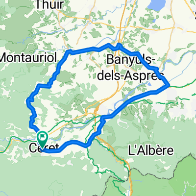
2013 Ride Day 6 - Céret Circle
A cycling route starting in Ceret, Occitanie, France.
Overview
About this route
This was one great ride with all excellent low traffic roads. Some of the vistas were incredible.
- -:--
- Duration
- 67.6 km
- Distance
- 1,119 m
- Ascent
- 1,119 m
- Descent
- ---
- Avg. speed
- ---
- Max. altitude

Route quality
Waytypes & surfaces along the route
Waytypes
Road
32.4 km
(48 %)
Quiet road
6.1 km
(9 %)
Surfaces
Paved
34.5 km
(51 %)
Unpaved
4.7 km
(7 %)
Asphalt
34.5 km
(51 %)
Gravel
4.7 km
(7 %)
Undefined
28.4 km
(42 %)
Continue with Bikemap
Use, edit, or download this cycling route
You would like to ride 2013 Ride Day 6 - Céret Circle or customize it for your own trip? Here is what you can do with this Bikemap route:
Free features
- Save this route as favorite or in collections
- Copy & plan your own version of this route
- Sync your route with Garmin or Wahoo
Premium features
Free trial for 3 days, or one-time payment. More about Bikemap Premium.
- Navigate this route on iOS & Android
- Export a GPX / KML file of this route
- Create your custom printout (try it for free)
- Download this route for offline navigation
Discover more Premium features.
Get Bikemap PremiumFrom our community
Other popular routes starting in Ceret
 Céret–Montauriol-Céret
- Distance
- 52.8 km
- Ascent
- 893 m
- Descent
- 920 m
- Location
- Ceret, Occitanie, France
 Céret-Oms-Col de Fourtou-Amélie-Céret
- Distance
- 48.8 km
- Ascent
- 875 m
- Descent
- 889 m
- Location
- Ceret, Occitanie, France
 font frede
- Distance
- 42.4 km
- Ascent
- 1,048 m
- Descent
- 1,044 m
- Location
- Ceret, Occitanie, France
 puig forcat, via het dorpje Les Illas
- Distance
- 41.2 km
- Ascent
- 1,013 m
- Descent
- 1,018 m
- Location
- Ceret, Occitanie, France
 Céret – Roses
- Distance
- 57.8 km
- Ascent
- 410 m
- Descent
- 592 m
- Location
- Ceret, Occitanie, France
 Nice tour starting in Ceret
- Distance
- 27.7 km
- Ascent
- 515 m
- Descent
- 515 m
- Location
- Ceret, Occitanie, France
 Céret-Col de Llauro-Pleine du Rousillon-Céret
- Distance
- 49.6 km
- Ascent
- 419 m
- Descent
- 422 m
- Location
- Ceret, Occitanie, France
 Céret–Oms–Castelnou–Thuir–Fourques-Céret
- Distance
- 61 km
- Ascent
- 971 m
- Descent
- 961 m
- Location
- Ceret, Occitanie, France
Open it in the app