

Courmayeur naar Cap d'Ail
A cycling route starting in Prè-Saint-Didier, Aosta Valley, Italy.
Overview
About this route
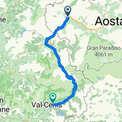
Route van Courmayeur naar Cap d'Ail
- -:--
- Duration
- 558.4 km
- Distance
- 10,708 m
- Ascent
- 11,739 m
- Descent
- ---
- Avg. speed
- ---
- Max. altitude
Continue with Bikemap
Use, edit, or download this cycling route
You would like to ride Courmayeur naar Cap d'Ail or customize it for your own trip? Here is what you can do with this Bikemap route:
Free features
- Save this route as favorite or in collections
- Copy & plan your own version of this route
- Split it into stages to create a multi-day tour
- Sync your route with Garmin or Wahoo
Premium features
Free trial for 3 days, or one-time payment. More about Bikemap Premium.
- Navigate this route on iOS & Android
- Export a GPX / KML file of this route
- Create your custom printout (try it for free)
- Download this route for offline navigation
Discover more Premium features.
Get Bikemap PremiumFrom our community
Other popular routes starting in Prè-Saint-Didier
 Tour des Alpes occidentales 4. Etappe
- Distance
- 61.1 km
- Ascent
- 1,896 m
- Descent
- 1,090 m
- Location
- Prè-Saint-Didier, Aosta Valley, Italy
 5: PRÉ-SAINT-DIDIER / COLLE DEL GRAN SAN BERNARDO
- Distance
- 87.3 km
- Ascent
- 2,697 m
- Descent
- 1,273 m
- Location
- Prè-Saint-Didier, Aosta Valley, Italy
 Tag 4 Pre St Didier- Val Savarenche Hotel du Paradis 2.0
- Distance
- 46.5 km
- Ascent
- 1,549 m
- Descent
- 890 m
- Location
- Prè-Saint-Didier, Aosta Valley, Italy
 TMB Stage1
- Distance
- 142.2 km
- Ascent
- 3,020 m
- Descent
- 3,001 m
- Location
- Prè-Saint-Didier, Aosta Valley, Italy
 Colle della croce
- Distance
- 6 km
- Ascent
- 511 m
- Descent
- 34 m
- Location
- Prè-Saint-Didier, Aosta Valley, Italy
 AlpenTour2018_E5-8
- Distance
- 129.3 km
- Ascent
- 1,944 m
- Descent
- 2,526 m
- Location
- Prè-Saint-Didier, Aosta Valley, Italy
 3. Tag
- Distance
- 111.5 km
- Ascent
- 3,189 m
- Descent
- 2,849 m
- Location
- Prè-Saint-Didier, Aosta Valley, Italy
 Courmayeur
- Distance
- 61.6 km
- Ascent
- 1,561 m
- Descent
- 1,572 m
- Location
- Prè-Saint-Didier, Aosta Valley, Italy
Open it in the app