

Nýznerovské vodopády, Smrk, Lesní bar
A cycling route starting in Žulová, Olomoucký kraj, Czechia.
Overview
About this route
1
- -:--
- Duration
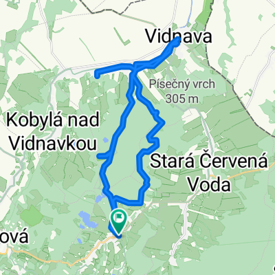
- 54.3 km
- Distance
- 959 m
- Ascent
- 947 m
- Descent
- ---
- Avg. speed
- ---
- Max. altitude
Continue with Bikemap
Use, edit, or download this cycling route
You would like to ride Nýznerovské vodopády, Smrk, Lesní bar or customize it for your own trip? Here is what you can do with this Bikemap route:
Free features
- Save this route as favorite or in collections
- Copy & plan your own version of this route
- Sync your route with Garmin or Wahoo
Premium features
Free trial for 3 days, or one-time payment. More about Bikemap Premium.
- Navigate this route on iOS & Android
- Export a GPX / KML file of this route
- Create your custom printout (try it for free)
- Download this route for offline navigation
Discover more Premium features.
Get Bikemap PremiumFrom our community
Other popular routes starting in Žulová
 Rychlebské stezky CLONED FROM ROUTE 420610
- Distance
- 22.6 km
- Ascent
- 658 m
- Descent
- 657 m
- Location
- Žulová, Olomoucký kraj, Czechia
 zakladna - start superflow2
- Distance
- 7 km
- Ascent
- 500 m
- Descent
- 98 m
- Location
- Žulová, Olomoucký kraj, Czechia
 Rychleby den 2
- Distance
- 69.3 km
- Ascent
- 1,361 m
- Descent
- 1,361 m
- Location
- Žulová, Olomoucký kraj, Czechia
 Trail podél Černého potoka
- Distance
- 24.5 km
- Ascent
- 247 m
- Descent
- 247 m
- Location
- Žulová, Olomoucký kraj, Czechia
 Rychlebské stezky SUPERFLOW+VELRYBA+VIDNAVSKY OKRUH
- Distance
- 39.4 km
- Ascent
- 650 m
- Descent
- 650 m
- Location
- Žulová, Olomoucký kraj, Czechia
 Rychlebky 2
- Distance
- 47.7 km
- Ascent
- 544 m
- Descent
- 537 m
- Location
- Žulová, Olomoucký kraj, Czechia
 Nýznerovské vodopády, Smrk, Lesní bar
- Distance
- 54.3 km
- Ascent
- 959 m
- Descent
- 947 m
- Location
- Žulová, Olomoucký kraj, Czechia
 Rychlebské stezky 2010
- Distance
- 24.6 km
- Ascent
- 686 m
- Descent
- 684 m
- Location
- Žulová, Olomoucký kraj, Czechia
Open it in the app