

Seiseralm-Compatsch-Wolkenstein-Corvara-Passo Valparola-Araba-Pordoi-Covara-Kastelruth-Seiseralm
A cycling route starting in Fiè Allo Sciliar, Trentino-Alto Adige, Italy.
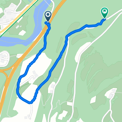
Overview
About this route
crazy
- -:--
- Duration
- 155.8 km
- Distance
- 3,861 m
- Ascent
- 3,858 m
- Descent
- ---
- Avg. speed
- ---
- Max. altitude
Route quality
Waytypes & surfaces along the route
Waytypes
Road
14 km
(9 %)
Quiet road
6.2 km
(4 %)
Surfaces
Paved
138.7 km
(89 %)
Unpaved
7.8 km
(5 %)
Asphalt
138.7 km
(89 %)
Gravel
6.2 km
(4 %)
Continue with Bikemap
Use, edit, or download this cycling route
You would like to ride Seiseralm-Compatsch-Wolkenstein-Corvara-Passo Valparola-Araba-Pordoi-Covara-Kastelruth-Seiseralm or customize it for your own trip? Here is what you can do with this Bikemap route:
Free features
- Save this route as favorite or in collections
- Copy & plan your own version of this route
- Split it into stages to create a multi-day tour
- Sync your route with Garmin or Wahoo
Premium features
Free trial for 3 days, or one-time payment. More about Bikemap Premium.
- Navigate this route on iOS & Android
- Export a GPX / KML file of this route
- Create your custom printout (try it for free)
- Download this route for offline navigation
Discover more Premium features.
Get Bikemap PremiumFrom our community
Other popular routes starting in Fiè Allo Sciliar
 Da Autostrada del Brennero, Fiè allo Sciliar a Frazione Novale di Fié, Fiè allo Sciliar
- Distance
- 1.3 km
- Ascent
- 129 m
- Descent
- 7 m
- Location
- Fiè Allo Sciliar, Trentino-Alto Adige, Italy
 Seiser Alm-Sterzing-Penser Joch-Bozen-Seiser Alm
- Distance
- 154.4 km
- Ascent
- 2,556 m
- Descent
- 2,556 m
- Location
- Fiè Allo Sciliar, Trentino-Alto Adige, Italy
 1_DOLOMITI MTB - 1
- Distance
- 29.6 km
- Ascent
- 1,798 m
- Descent
- 365 m
- Location
- Fiè Allo Sciliar, Trentino-Alto Adige, Italy
 Via San Costantino, Völs am Schlern do Via Sciliar 39, Kastelruth
- Distance
- 4.4 km
- Ascent
- 164 m
- Descent
- 52 m
- Location
- Fiè Allo Sciliar, Trentino-Alto Adige, Italy
 Seiseralm - Arco
- Distance
- 136.5 km
- Ascent
- 1,906 m
- Descent
- 2,661 m
- Location
- Fiè Allo Sciliar, Trentino-Alto Adige, Italy
 nigerpass und karerpass
- Distance
- 76 km
- Ascent
- 2,126 m
- Descent
- 2,139 m
- Location
- Fiè Allo Sciliar, Trentino-Alto Adige, Italy
 Schlern und Hammerwand
- Distance
- 31 km
- Ascent
- 1,149 m
- Descent
- 1,149 m
- Location
- Fiè Allo Sciliar, Trentino-Alto Adige, Italy
 Seiseralm-Compatsch-Wolkenstein-Corvara-Passo Valparola-Araba-Pordoi-Covara-Kastelruth-Seiseralm
- Distance
- 155.8 km
- Ascent
- 3,861 m
- Descent
- 3,858 m
- Location
- Fiè Allo Sciliar, Trentino-Alto Adige, Italy
Open it in the app