
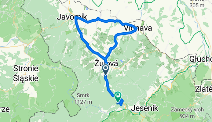
Okolo Vápenné
A cycling route starting in Vápenná, Olomoucký kraj, Czechia.
Overview
About this route
Course of the race Around Wapienna on September 8, 2013, start at 10:00, registration until 9:45 at the sports field in Vapenna (to the right after the level crossing). Entry fee - 80 Crowns.
- -:--
- Duration
- 51.7 km
- Distance
- 535 m
- Ascent
- 255 m
- Descent
- ---
- Avg. speed
- ---
- Max. altitude

Route quality
Waytypes & surfaces along the route
Waytypes
Road
10.3 km
(20 %)
Access road
1.5 km
(3 %)
Surfaces
Paved
44.4 km
(86 %)
Asphalt
44.4 km
(86 %)
Undefined
7.2 km
(14 %)
Continue with Bikemap
Use, edit, or download this cycling route
You would like to ride Okolo Vápenné or customize it for your own trip? Here is what you can do with this Bikemap route:
Free features
- Save this route as favorite or in collections
- Copy & plan your own version of this route
- Sync your route with Garmin or Wahoo
Premium features
Free trial for 3 days, or one-time payment. More about Bikemap Premium.
- Navigate this route on iOS & Android
- Export a GPX / KML file of this route
- Create your custom printout (try it for free)
- Download this route for offline navigation
Discover more Premium features.
Get Bikemap PremiumFrom our community
Other popular routes starting in Vápenná
 Sernatto - Jeseníky
- Distance
- 36.8 km
- Ascent
- 855 m
- Descent
- 855 m
- Location
- Vápenná, Olomoucký kraj, Czechia
 ou751der's VKJ 2016 den 4
- Distance
- 89.7 km
- Ascent
- 1,321 m
- Descent
- 1,772 m
- Location
- Vápenná, Olomoucký kraj, Czechia
 Rychlebské hory
- Distance
- 18 km
- Ascent
- 595 m
- Descent
- 659 m
- Location
- Vápenná, Olomoucký kraj, Czechia
 Vápenná - Opava (přes Polsko)
- Distance
- 111.1 km
- Ascent
- 520 m
- Descent
- 680 m
- Location
- Vápenná, Olomoucký kraj, Czechia
 jak jsme si zajeli cestou na Smrk
- Distance
- 5.9 km
- Ascent
- 275 m
- Descent
- 257 m
- Location
- Vápenná, Olomoucký kraj, Czechia
 Hranice mezi Moravou a Slezskem
- Distance
- 330.1 km
- Ascent
- 6,142 m
- Descent
- 6,389 m
- Location
- Vápenná, Olomoucký kraj, Czechia
 Śnieżnik+ Czarna Góra (w 2 dni)
- Distance
- 102.6 km
- Ascent
- 2,187 m
- Descent
- 2,340 m
- Location
- Vápenná, Olomoucký kraj, Czechia
 Nýznerov Sedlo Peklo Rychlebské hory
- Distance
- 24.2 km
- Ascent
- 516 m
- Descent
- 516 m
- Location
- Vápenná, Olomoucký kraj, Czechia
Open it in the app