

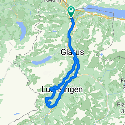
CH-Ost: Oberurnen - Kerenzerberg - Flumserberg
A cycling route starting in Oberurnen, Canton of Glarus, Switzerland.
Overview
About this route
with return 82.8 km Route without highway
- -:--
- Duration
- 41.4 km
- Distance
- 1,283 m
- Ascent
- 389 m
- Descent
- ---
- Avg. speed
- ---
- Max. altitude
Route quality
Waytypes & surfaces along the route
Waytypes
Quiet road
2.5 km
(6 %)
Access road
1.7 km
(4 %)
Surfaces
Paved
39.7 km
(96 %)
Asphalt
39.7 km
(96 %)
Undefined
1.7 km
(4 %)
Continue with Bikemap
Use, edit, or download this cycling route
You would like to ride CH-Ost: Oberurnen - Kerenzerberg - Flumserberg or customize it for your own trip? Here is what you can do with this Bikemap route:
Free features
- Save this route as favorite or in collections
- Copy & plan your own version of this route
- Sync your route with Garmin or Wahoo
Premium features
Free trial for 3 days, or one-time payment. More about Bikemap Premium.
- Navigate this route on iOS & Android
- Export a GPX / KML file of this route
- Create your custom printout (try it for free)
- Download this route for offline navigation
Discover more Premium features.
Get Bikemap PremiumFrom our community
Other popular routes starting in Oberurnen
 Pragel - Klausen
- Distance
- 141.5 km
- Ascent
- 2,580 m
- Descent
- 2,581 m
- Location
- Oberurnen, Canton of Glarus, Switzerland
 Oberurnen-Braunwald ret..gpx
- Distance
- 59.3 km
- Ascent
- 1,125 m
- Descent
- 1,124 m
- Location
- Oberurnen, Canton of Glarus, Switzerland
 Näfels-Lenzerheide
- Distance
- 88.1 km
- Ascent
- 1,239 m
- Descent
- 189 m
- Location
- Oberurnen, Canton of Glarus, Switzerland
 Giessen 1, Oberurnen nach Gäsistrasse 99, Filzbach
- Distance
- 5.1 km
- Ascent
- 9 m
- Descent
- 10 m
- Location
- Oberurnen, Canton of Glarus, Switzerland
 Hintere Sonnenalp, Näfels nach Bahnhofstrasse 6, Niederurnen
- Distance
- 13.3 km
- Ascent
- 1,163 m
- Descent
- 2,124 m
- Location
- Oberurnen, Canton of Glarus, Switzerland
 Dreitagestour Schweiz, Tag 2
- Distance
- 100 km
- Ascent
- 1,373 m
- Descent
- 1,329 m
- Location
- Oberurnen, Canton of Glarus, Switzerland
 Kurze Rundstrecke mit steinigem Singletrail
- Distance
- 7.6 km
- Ascent
- 327 m
- Descent
- 325 m
- Location
- Oberurnen, Canton of Glarus, Switzerland
 Vordere Sonnenalp 7, Näfels nach Alte Landstrasse 26, Oberurnen
- Distance
- 11.1 km
- Ascent
- 28 m
- Descent
- 900 m
- Location
- Oberurnen, Canton of Glarus, Switzerland
Open it in the app