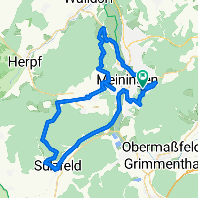
067 Zipfeltour2013 Tag07 Meiningen-Ruhla
A cycling route starting in Meiningen, Thuringia, Germany.
Overview
About this route
The form of the day should decide! For the stage, I had set myself two alternative goals: either to Herleshausen, so to speak around the Thuringian Forest, or to Ruhla, the shorter but also steeper stage over the Rennsteig. Initially, however, the Thuringian bike paths forced me to turn back for the first time. The Werratal bike path along the railway line in Schwallungen was impassable - so back and the alternative route via Niederschmalkalden was chosen. In Breitungen the decision was then made, I decided to take the almost 4 quintals (bike, luggage and ME) into the mountains. West of Schweina on Friedhofstraße a first breather, I was actually already exhausted, but turning back a second time was out of the question today - just good that I didn’t know what lay ahead. Onward I went past Arnsberg and around the big Kissel. Not only did the slope seem endless, but the whole way was beautifully “paved” with coarse, sharp-edged gravel - my bike actually hurt more than I did. Finally rode a piece of Rennsteig and then down to Ruhla. I think, even without luggage, this part of the day would have been quite demanding - I, in any case, was pretty worn out at the day’s goal. I spent the night at the Klosterschänke in Thal and also had my own chapel at the hotel ;-)
- -:--
- Duration
- 57.9 km
- Distance
- 504 m
- Ascent
- 466 m
- Descent
- ---
- Avg. speed
- ---
- Max. altitude
Route quality
Waytypes & surfaces along the route
Waytypes
Track
21.4 km
(37 %)
Quiet road
10.4 km
(18 %)
Surfaces
Paved
30.7 km
(53 %)
Unpaved
15.6 km
(27 %)
Asphalt
30.1 km
(52 %)
Gravel
13.9 km
(24 %)
Continue with Bikemap
Use, edit, or download this cycling route
You would like to ride 067 Zipfeltour2013 Tag07 Meiningen-Ruhla or customize it for your own trip? Here is what you can do with this Bikemap route:
Free features
- Save this route as favorite or in collections
- Copy & plan your own version of this route
- Sync your route with Garmin or Wahoo
Premium features
Free trial for 3 days, or one-time payment. More about Bikemap Premium.
- Navigate this route on iOS & Android
- Export a GPX / KML file of this route
- Create your custom printout (try it for free)
- Download this route for offline navigation
Discover more Premium features.
Get Bikemap PremiumFrom our community
Other popular routes starting in Meiningen
 Noch 'ne 'kleine' Abendrunde - Stage 2
- Distance
- 45.2 km
- Ascent
- 632 m
- Descent
- 697 m
- Location
- Meiningen, Thuringia, Germany
 MGN - Dreißigacker - Sülzfeld - Fasanerie - MGN
- Distance
- 29.7 km
- Ascent
- 331 m
- Descent
- 338 m
- Location
- Meiningen, Thuringia, Germany
 Rundfahrt mit Eike
- Distance
- 35.1 km
- Ascent
- 374 m
- Descent
- 388 m
- Location
- Meiningen, Thuringia, Germany
 Meiningen/Werra nach Bad Kissingen/Rhön CLONED FROM ROUTE 1904
- Distance
- 68.2 km
- Ascent
- 312 m
- Descent
- 397 m
- Location
- Meiningen, Thuringia, Germany
 067 Zipfeltour2013 Tag07 Meiningen-Ruhla
- Distance
- 57.9 km
- Ascent
- 504 m
- Descent
- 466 m
- Location
- Meiningen, Thuringia, Germany
 Meiningen-Kühndorf-Metzels-Oberwallbachmühle-MGN
- Distance
- 30.3 km
- Ascent
- 409 m
- Descent
- 432 m
- Location
- Meiningen, Thuringia, Germany
 Am Wandervogel 37, Meiningen nach Am Wandervogel 37, Meiningen
- Distance
- 31.4 km
- Ascent
- 491 m
- Descent
- 491 m
- Location
- Meiningen, Thuringia, Germany
 2025-05-09_Meinigen-Werra-Obersuhl
- Distance
- 85.6 km
- Ascent
- 503 m
- Descent
- 577 m
- Location
- Meiningen, Thuringia, Germany
Open it in the app


