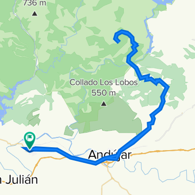
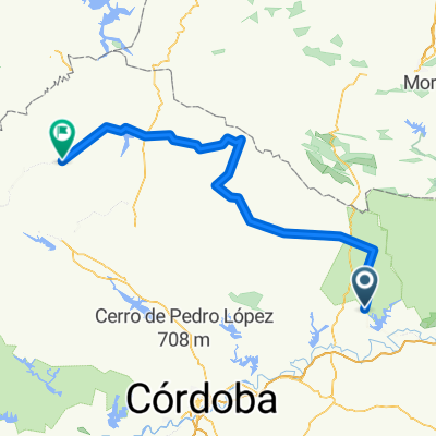
TAC Marmolejo (JaƩn) - Fuente Obejuna
A cycling route starting in Marmolejo, Andalusia, Spain.
Overview
About this route
TAC Stag 1 of Cordoba Marmolejo (JaƩn) - Fuente Obejuna.
- -:--
- Duration
- 184 km
- Distance
- 1,151 m
- Ascent
- 816 m
- Descent
- ---
- Avg. speed
- ---
- Max. altitude
Continue with Bikemap
Use, edit, or download this cycling route
You would like to ride TAC Marmolejo (JaƩn) - Fuente Obejuna or customize it for your own trip? Here is what you can do with this Bikemap route:
Free features
- Save this route as favorite or in collections
- Copy & plan your own version of this route
- Split it into stages to create a multi-day tour
- Sync your route with Garmin or Wahoo
Premium features
Free trial for 3 days, or one-time payment. More about Bikemap Premium.
- Navigate this route on iOS & Android
- Export a GPX / KML file of this route
- Create your custom printout (try it for free)
- Download this route for offline navigation
Discover more Premium features.
Get Bikemap PremiumFrom our community
Other popular routes starting in Marmolejo
- 1994 - Malaga - Narbonne - 05. Tag - Marmolejo - Desfiladero de Despeñaperros
- Distance
- 90.2 km
- Ascent
- 861 m
- Descent
- 441 m
- Location
- Marmolejo, Andalusia, Spain
- Fuente de la PeƱa- Arjonilla- Cortijos Santiago - Porcuna - Lopera - Marmolejo
- Distance
- 62.6 km
- Ascent
- 1,076 m
- Descent
- 1,081 m
- Location
- Marmolejo, Andalusia, Spain
- TAC Marmolejo (JaƩn) - Fuente Obejuna
- Distance
- 184 km
- Ascent
- 1,151 m
- Descent
- 816 m
- Location
- Marmolejo, Andalusia, Spain
- marmolejo-cardeƱa-montoro-marmolejo
- Distance
- 101 km
- Ascent
- 965 m
- Descent
- 966 m
- Location
- Marmolejo, Andalusia, Spain
- Calle de Manuel SanlĆŗcar, 2, Marmolejo a Calle del 20 de Octubre, 2ā4, Marmolejo
- Distance
- 61.6 km
- Ascent
- 771 m
- Descent
- 791 m
- Location
- Marmolejo, Andalusia, Spain
- De Glorieta MƔrtires 3, Marmolejo a Calle Calvario 25, Marmolejo
- Distance
- 65.9 km
- Ascent
- 982 m
- Descent
- 989 m
- Location
- Marmolejo, Andalusia, Spain
- 16-10-22 La Cuna-Valparroso-El Pintado
- Distance
- 31.1 km
- Ascent
- 881 m
- Descent
- 880 m
- Location
- Marmolejo, Andalusia, Spain
- Paseo rƔpido en Marmolejo
- Distance
- 16.6 km
- Ascent
- 315 m
- Descent
- 316 m
- Location
- Marmolejo, Andalusia, Spain
Open it in the app