

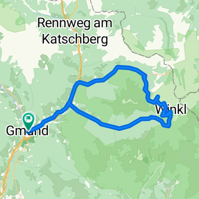
Nockalmrunde
A cycling route starting in Gmünd, Carinthia, Austria.
Overview
About this route
Kremsbrücke-Innerkrems-Nockalmstraße-St. Michael-Katschberg-Rennweg-Kremsbrücke
- -:--
- Duration
- 55.3 km
- Distance
- 1,479 m
- Ascent
- 1,478 m
- Descent
- ---
- Avg. speed
- ---
- Max. altitude

Route quality
Waytypes & surfaces along the route
Waytypes
Road
17.7 km
(32 %)
Track
4.4 km
(8 %)
Surfaces
Paved
17.7 km
(32 %)
Unpaved
3.3 km
(6 %)
Asphalt
17.7 km
(32 %)
Unpaved (undefined)
2.8 km
(5 %)
Continue with Bikemap
Use, edit, or download this cycling route
You would like to ride Nockalmrunde or customize it for your own trip? Here is what you can do with this Bikemap route:
Free features
- Save this route as favorite or in collections
- Copy & plan your own version of this route
- Sync your route with Garmin or Wahoo
Premium features
Free trial for 3 days, or one-time payment. More about Bikemap Premium.
- Navigate this route on iOS & Android
- Export a GPX / KML file of this route
- Create your custom printout (try it for free)
- Download this route for offline navigation
Discover more Premium features.
Get Bikemap PremiumFrom our community
Other popular routes starting in Gmünd
 Alpy 1.deň
- Distance
- 52.1 km
- Ascent
- 1,284 m
- Descent
- 1,284 m
- Location
- Gmünd, Carinthia, Austria
 MI9 Gmünd - Gemünder Hütte 21+21 350HM
- Distance
- 21.7 km
- Ascent
- 496 m
- Descent
- 39 m
- Location
- Gmünd, Carinthia, Austria
 Treffenboden 27 nach Blutige Alm
- Distance
- 58.3 km
- Ascent
- 1,430 m
- Descent
- 1,601 m
- Location
- Gmünd, Carinthia, Austria
 Maltaberg
- Distance
- 15.2 km
- Ascent
- 808 m
- Descent
- 808 m
- Location
- Gmünd, Carinthia, Austria
 Nockalm runde
- Distance
- 55 km
- Ascent
- 1,275 m
- Descent
- 1,280 m
- Location
- Gmünd, Carinthia, Austria
 Malta Hochalmstrasse
- Distance
- 47.4 km
- Ascent
- 1,165 m
- Descent
- 1,163 m
- Location
- Gmünd, Carinthia, Austria
 Nockalmrunde
- Distance
- 55.3 km
- Ascent
- 1,479 m
- Descent
- 1,478 m
- Location
- Gmünd, Carinthia, Austria
 Gmünd - Villach
- Distance
- 55 km
- Ascent
- 146 m
- Descent
- 352 m
- Location
- Gmünd, Carinthia, Austria
Open it in the app