

SK/Telgárt - PL/Zakopane
A cycling route starting in Dobšiná, Košice Region, Slovakia.
Overview
About this route
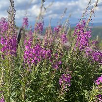
Gute Straßen! Erst durch Niedere Tatra, dann durch Hohe Tatra, beide Regionen sind landschaftlich interessant. Sehr Rücksicht auf Rennradfahrer nehmen die Slowakischen Autofahrer, was man von denen in Polen weniger sagen kann!
- -:--
- Duration
- 98.8 km
- Distance
- 1,877 m
- Ascent
- 1,820 m
- Descent
- ---
- Avg. speed
- 1,126 m
- Max. altitude

Route quality
Waytypes & surfaces along the route
Waytypes
Road
32.6 km
(33 %)
Cycleway
2 km
(2 %)
Surfaces
Paved
88.9 km
(90 %)
Unpaved
1 km
(1 %)
Asphalt
88.9 km
(90 %)
Gravel
1 km
(1 %)
Undefined
8.9 km
(9 %)
Continue with Bikemap
Use, edit, or download this cycling route
You would like to ride SK/Telgárt - PL/Zakopane or customize it for your own trip? Here is what you can do with this Bikemap route:
Free features
- Save this route as favorite or in collections
- Copy & plan your own version of this route
- Split it into stages to create a multi-day tour
- Sync your route with Garmin or Wahoo
Premium features
Free trial for 3 days, or one-time payment. More about Bikemap Premium.
- Navigate this route on iOS & Android
- Export a GPX / KML file of this route
- Create your custom printout (try it for free)
- Download this route for offline navigation
Discover more Premium features.
Get Bikemap PremiumFrom our community
Other popular routes starting in Dobšiná
 Telgárt - Mlynky - Nálepkovo - Gelnica - Margecany - Košice
- Distance
- 139.9 km
- Ascent
- 2,169 m
- Descent
- 2,837 m
- Location
- Dobšiná, Košice Region, Slovakia
 Telgárt, Telgárt až Telgárt, Telgárt
- Distance
- 48.5 km
- Ascent
- 1,792 m
- Descent
- 1,791 m
- Location
- Dobšiná, Košice Region, Slovakia
 Zelená stuha Horehronia
- Distance
- 54.8 km
- Ascent
- 979 m
- Descent
- 1,246 m
- Location
- Dobšiná, Košice Region, Slovakia
 SK/Telgárt - PL/Zakopane
- Distance
- 98.8 km
- Ascent
- 1,877 m
- Descent
- 1,820 m
- Location
- Dobšiná, Košice Region, Slovakia
 Šumiac, Kráľová Hoľa, Bartková,Pohorelá Šumiac
- Distance
- 39.1 km
- Ascent
- 1,338 m
- Descent
- 1,337 m
- Location
- Dobšiná, Košice Region, Slovakia
 Dedinky - Stratená - Stratenský kaňon - Dobšinská Maša - Dedinky CLONED FROM ROUTE 582102
- Distance
- 14.3 km
- Ascent
- 449 m
- Descent
- 445 m
- Location
- Dobšiná, Košice Region, Slovakia
 Iglói kör
- Distance
- 64.7 km
- Ascent
- 958 m
- Descent
- 957 m
- Location
- Dobšiná, Košice Region, Slovakia
 Telgárt, Telgárt až Muráň
- Distance
- 21.6 km
- Ascent
- 667 m
- Descent
- 694 m
- Location
- Dobšiná, Košice Region, Slovakia
Open it in the app