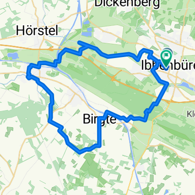
Lagg-FMO-Lagg
- 59.5 km
- 227 m
- 228 m
- Ibbenbueren, North Rhine-Westphalia, Germany
A cycling route starting in Ibbenbueren, North Rhine-Westphalia, Germany.
Overview
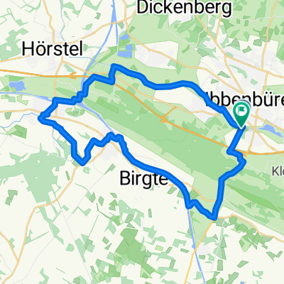
Part 2, again as a circular route
Route quality
Track
20.9 km
(34 %)
Path
10.4 km
(17 %)
Paved
20.3 km
(33 %)
Unpaved
23.3 km
(38 %)
Asphalt
19.6 km
(32 %)
Gravel
17.8 km
(29 %)
Continue with Bikemap
You would like to ride Hermannsweg II or customize it for your own trip? Here is what you can do with this Bikemap route:
Free trial for 3 days, or one-time payment. More about Bikemap Premium.
Discover more Premium features.
Get Bikemap PremiumFrom our community
Open it in the app