

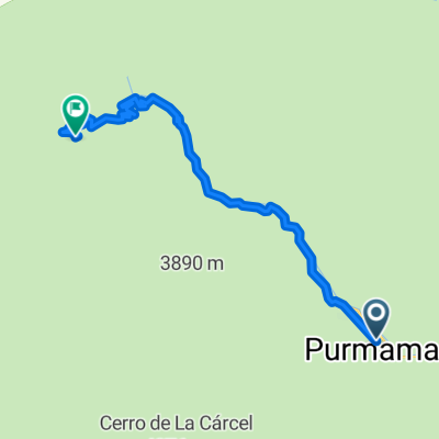
Purmamarca-San Antonio de los Cobres
A cycling route starting in Tumbaya, Jujuy Province, Argentina.
Overview
About this route
from the Cerro de los 7 colores to the Puna Salteña passing by the Cuesta del Lipan and the Salinas Grandes
- -:--
- Duration
- 154.8 km
- Distance
- 2,228 m
- Ascent
- 781 m
- Descent
- ---
- Avg. speed
- ---
- Max. altitude
Continue with Bikemap
Use, edit, or download this cycling route
You would like to ride Purmamarca-San Antonio de los Cobres or customize it for your own trip? Here is what you can do with this Bikemap route:
Free features
- Save this route as favorite or in collections
- Copy & plan your own version of this route
- Split it into stages to create a multi-day tour
- Sync your route with Garmin or Wahoo
Premium features
Free trial for 3 days, or one-time payment. More about Bikemap Premium.
- Navigate this route on iOS & Android
- Export a GPX / KML file of this route
- Create your custom printout (try it for free)
- Download this route for offline navigation
Discover more Premium features.
Get Bikemap PremiumFrom our community
Other popular routes starting in Tumbaya
 Day3_Purmamarca-Humauaca
- Distance
- 69.9 km
- Ascent
- 827 m
- Descent
- 213 m
- Location
- Tumbaya, Jujuy Province, Argentina
 Purmamarca (Ar) hasta Tocopilla (Cl)
- Distance
- 659 km
- Ascent
- 5,399 m
- Descent
- 7,580 m
- Location
- Tumbaya, Jujuy Province, Argentina
 Purmamarca- posada de los diques
- Distance
- 95.2 km
- Ascent
- 230 m
- Descent
- 1,332 m
- Location
- Tumbaya, Jujuy Province, Argentina
 c4- Purmamarca a Huacalera
- Distance
- 41.3 km
- Ascent
- 543 m
- Descent
- 211 m
- Location
- Tumbaya, Jujuy Province, Argentina
 Purmamarca - Tilcara
- Distance
- 70.8 km
- Ascent
- 1,364 m
- Descent
- 742 m
- Location
- Tumbaya, Jujuy Province, Argentina
 Purmamarca - Salinas - SACobres - Salta
- Distance
- 325.5 km
- Ascent
- 2,536 m
- Descent
- 3,685 m
- Location
- Tumbaya, Jujuy Province, Argentina
 Purmamarca a Salinas Grandes
- Distance
- 58.6 km
- Ascent
- 816 m
- Descent
- 1,901 m
- Location
- Tumbaya, Jujuy Province, Argentina
 Nacional
- Distance
- 24.7 km
- Ascent
- 1,265 m
- Descent
- 44 m
- Location
- Tumbaya, Jujuy Province, Argentina
Open it in the app