

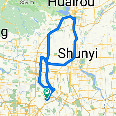
Road to Tiantongyuan North
A cycling route starting in Sunhe, Beijing Municipality, China.
Overview
About this route
route to gathering point
- -:--
- Duration
- 14.9 km
- Distance
- 43 m
- Ascent
- 25 m
- Descent
- ---
- Avg. speed
- ---
- Max. altitude
Continue with Bikemap
Use, edit, or download this cycling route
You would like to ride Road to Tiantongyuan North or customize it for your own trip? Here is what you can do with this Bikemap route:
Free features
- Save this route as favorite or in collections
- Copy & plan your own version of this route
- Sync your route with Garmin or Wahoo
Premium features
Free trial for 3 days, or one-time payment. More about Bikemap Premium.
- Navigate this route on iOS & Android
- Export a GPX / KML file of this route
- Create your custom printout (try it for free)
- Download this route for offline navigation
Discover more Premium features.
Get Bikemap PremiumFrom our community
Other popular routes starting in Sunhe
 Capital Paradise to Western Academy of Beijing loop
- Distance
- 19.6 km
- Ascent
- 58 m
- Descent
- 59 m
- Location
- Sunhe, Beijing Municipality, China
 Mountains out and back
- Distance
- 148.9 km
- Ascent
- 836 m
- Descent
- 836 m
- Location
- Sunhe, Beijing Municipality, China
 Death Valley
- Distance
- 104 km
- Ascent
- 421 m
- Descent
- 421 m
- Location
- Sunhe, Beijing Municipality, China
 Road to Tiantongyuan North
- Distance
- 14.9 km
- Ascent
- 43 m
- Descent
- 25 m
- Location
- Sunhe, Beijing Municipality, China
 Cracking ride in Beijing
- Distance
- 17.2 km
- Ascent
- 12 m
- Descent
- 13 m
- Location
- Sunhe, Beijing Municipality, China
 Riviera-Peloton Miyun Loop-and back
- Distance
- 283.3 km
- Ascent
- 889 m
- Descent
- 889 m
- Location
- Sunhe, Beijing Municipality, China
 Daily 10km ride
- Distance
- 11.9 km
- Ascent
- 38 m
- Descent
- 35 m
- Location
- Sunhe, Beijing Municipality, China
 Riviera Huairou longer loop
- Distance
- 94.9 km
- Ascent
- 101 m
- Descent
- 106 m
- Location
- Sunhe, Beijing Municipality, China
Open it in the app