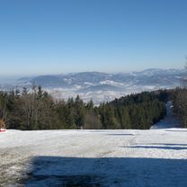
Jaworowy - Ostry
- 51.3 km
- 1,528 m
- 1,505 m
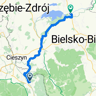
- Třinec, Moravskoslezský kraj, Czechia
A cycling route starting in Třinec, Moravskoslezský kraj, Czechia.
Overview
Road - Jeseniky 2013 - Ver. 1
created this 12 years ago
Route quality
Road
56.9 km
(32 %)
Quiet road
35.6 km
(20 %)
Paved
74.7 km
(42 %)
Asphalt
74.7 km
(42 %)
Undefined
103.2 km
(58 %)
Route highlights

Zástavka č. 1: Košatka - restaurace Odra čp 119 739 23 Stará Ves nad Ondřejnicí - Košatka

Zástavka č. 2: Restaurace U Marka Leskovec nad Moravicí č.329

END: Penzion Restaurace U Julka - Bělá pod Pradědem, Domašov
Continue with Bikemap
You would like to ride 2013-09-12 Bystrice-Hradec n.Moravici-Bruntal-Vrbno p.Pradedem-Bela p.Pradedem - Ver. 1 or customize it for your own trip? Here is what you can do with this Bikemap route:
Free trial for 3 days, or one-time payment. More about Bikemap Premium.
Discover more Premium features.
Get Bikemap PremiumFrom our community
Open it in the app