

RNR CAMP #2 -a-
A cycling route starting in Livinhac-le-Haut, Occitanie, France.
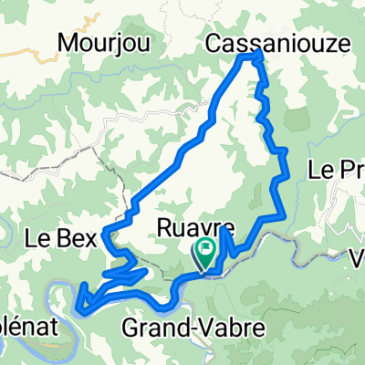
Overview
About this route
Paysages superbes, difficultés moyennes
- -:--
- Duration
- 228.1 km
- Distance
- 2,469 m
- Ascent
- 2,273 m
- Descent
- ---
- Avg. speed
- ---
- Max. altitude
Route quality
Waytypes & surfaces along the route
Waytypes
Road
29.7 km
(13 %)
Quiet road
11.4 km
(5 %)
Surfaces
Paved
123.2 km
(54 %)
Asphalt
123.2 km
(54 %)
Undefined
104.9 km
(46 %)
Continue with Bikemap
Use, edit, or download this cycling route
You would like to ride RNR CAMP #2 -a- or customize it for your own trip? Here is what you can do with this Bikemap route:
Free features
- Save this route as favorite or in collections
- Copy & plan your own version of this route
- Split it into stages to create a multi-day tour
- Sync your route with Garmin or Wahoo
Premium features
Free trial for 3 days, or one-time payment. More about Bikemap Premium.
- Navigate this route on iOS & Android
- Export a GPX / KML file of this route
- Create your custom printout (try it for free)
- Download this route for offline navigation
Discover more Premium features.
Get Bikemap PremiumFrom our community
Other popular routes starting in Livinhac-le-Haut
 Lot3
Lot3- Distance
- 25.1 km
- Ascent
- 646 m
- Descent
- 625 m
- Location
- Livinhac-le-Haut, Occitanie, France
 Deutschland - Portugal (Berlin - Faro) FR 24 Livinhac-le-Haut - Cajarc
- Distance
- 49.5 km
- Ascent
- 482 m
- Descent
- 529 m
- Location
- Livinhac-le-Haut, Occitanie, France
 5. Livinhac - Condom
- Distance
- 236.9 km
- Ascent
- 3,496 m
- Descent
- 3,622 m
- Location
- Livinhac-le-Haut, Occitanie, France
 6. etapa Coursavy - St Chely d Aubrac
- Distance
- 80.3 km
- Ascent
- 1,318 m
- Descent
- 712 m
- Location
- Livinhac-le-Haut, Occitanie, France
 2019-30 Montmurat Bagnac to Limogne-en-Quercy
- Distance
- 57.7 km
- Ascent
- 646 m
- Descent
- 650 m
- Location
- Livinhac-le-Haut, Occitanie, France
 Pont de Coursavy - Aurillac (Nr. 133)
- Distance
- 45.6 km
- Ascent
- 858 m
- Descent
- 464 m
- Location
- Livinhac-le-Haut, Occitanie, France
 Les volcans - Bordeaux
- Distance
- 408.3 km
- Ascent
- 542 m
- Descent
- 724 m
- Location
- Livinhac-le-Haut, Occitanie, France
 Pont de Coursavy - Corn (Nr. 102 + 99)
- Distance
- 59.2 km
- Ascent
- 896 m
- Descent
- 880 m
- Location
- Livinhac-le-Haut, Occitanie, France
Open it in the app