

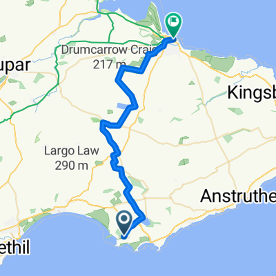
St Margaret's Elbow- via Crail and Fife Ness to St Andrews
A cycling route starting in Saint Monans, Scotland, United Kingdom.
Overview
About this route
This extension of St Margaret's Way continues along Fife Coastal path through ancient fishing villages along beaches and over rocks until the spires of St Andrews come into view over miles of rolling fairways. The path continues up through the harbour into the precincts of the ruined cathedral. Pubs etc along the way to Crail and great opportunities for wild camping. Cyclists may have to dismount at times.
Part of The Way of St Andrews - For other routes see http://www.thewayofstandrews.com
- -:--
- Duration
- 37.4 km
- Distance
- 174 m
- Ascent
- 159 m
- Descent
- ---
- Avg. speed
- ---
- Max. altitude

Route highlights
Points of interest along the route
Point of interest after 10.6 km
The Dreel Burn. King James IV (1473-1513) disguised as a piper was carried over this burn by a "stout gaberlunzie" woman and rewarded with his purse. "Gaberlunzie" is a medieval Scots word for licensed beggar.

Point of interest after 25.8 km
As glaciers advanced during the last ice age over 10,000 years ago they chipped off boulders and carried them along sometimes hundreds of miles. When the ice melted the boulders, like these ones here, were simply dumped. Thanks to geoHeritage Fife for advice and image.

Point of interest after 28.2 km
Here the sandstone contains many little pits which form parallel rows about 20 cm apart. Some rows cross over each other .These pits represent the footprints of a millipede-type animal, about 1.5 m long, which lived about 330 million years ago. At that time it was probably the largest land animal. Thanks to geoHeritage Fife for advice and image.
Point of interest after 30.7 km
Peekie Bridge over Kenly Burn, with panel showing arms of Prior Hepburn, in office around 1500.
Continue with Bikemap
Use, edit, or download this cycling route
You would like to ride St Margaret's Elbow- via Crail and Fife Ness to St Andrews or customize it for your own trip? Here is what you can do with this Bikemap route:
Free features
- Save this route as favorite or in collections
- Copy & plan your own version of this route
- Sync your route with Garmin or Wahoo
Premium features
Free trial for 3 days, or one-time payment. More about Bikemap Premium.
- Navigate this route on iOS & Android
- Export a GPX / KML file of this route
- Create your custom printout (try it for free)
- Download this route for offline navigation
Discover more Premium features.
Get Bikemap PremiumFrom our community
Other popular routes starting in Saint Monans
 St.Monans Loop
- Distance
- 14.7 km
- Ascent
- 74 m
- Descent
- 66 m
- Location
- Saint Monans, Scotland, United Kingdom
 Route from Woodland Way, Kilconquhar, Leven
- Distance
- 4.6 km
- Ascent
- 20 m
- Descent
- 42 m
- Location
- Saint Monans, Scotland, United Kingdom
 14, Marine Park, Leven to A917, Broomlees, Kilconquhar, Leven
- Distance
- 2.7 km
- Ascent
- 22 m
- Descent
- 8 m
- Location
- Saint Monans, Scotland, United Kingdom
 South Wynd 16, Colinsburgh to South Wynd 16, Colinsburgh
- Distance
- 59.2 km
- Ascent
- 220 m
- Descent
- 275 m
- Location
- Saint Monans, Scotland, United Kingdom
 The Toft 16, Elie to Tolbooth Wynd 1a, Crail
- Distance
- 20 km
- Ascent
- 170 m
- Descent
- 141 m
- Location
- Saint Monans, Scotland, United Kingdom
 St Margaret's Elbow- via Crail and Fife Ness to St Andrews
- Distance
- 37.4 km
- Ascent
- 174 m
- Descent
- 159 m
- Location
- Saint Monans, Scotland, United Kingdom
 Saint Monans - St Andrews
- Distance
- 25.3 km
- Ascent
- 197 m
- Descent
- 190 m
- Location
- Saint Monans, Scotland, United Kingdom
 Woodland Way, Kilconquhar, Leven to Woodland Way, Kilconquhar, Leven
- Distance
- 14.6 km
- Ascent
- 96 m
- Descent
- 92 m
- Location
- Saint Monans, Scotland, United Kingdom
Open it in the app