

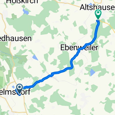
Zussdorf-Hohentengen-Koenigsegg
A cycling route starting in Wilhelmsdorf, Baden-Wurttemberg, Germany.
Overview
About this route
Zussdorf-Hohentengen-Koenigsegg
(cloned from route 2320429)- -:--
- Duration
- 81.4 km
- Distance
- 391 m
- Ascent
- 390 m
- Descent
- ---
- Avg. speed
- ---
- Max. altitude
Route quality
Waytypes & surfaces along the route
Waytypes
Road
40.5 km
(50 %)
Quiet road
31.3 km
(38 %)
Surfaces
Paved
68.1 km
(84 %)
Asphalt
67.7 km
(83 %)
Paved (undefined)
0.4 km
(<1 %)
Undefined
13.3 km
(16 %)
Continue with Bikemap
Use, edit, or download this cycling route
You would like to ride Zussdorf-Hohentengen-Koenigsegg or customize it for your own trip? Here is what you can do with this Bikemap route:
Free features
- Save this route as favorite or in collections
- Copy & plan your own version of this route
- Split it into stages to create a multi-day tour
- Sync your route with Garmin or Wahoo
Premium features
Free trial for 3 days, or one-time payment. More about Bikemap Premium.
- Navigate this route on iOS & Android
- Export a GPX / KML file of this route
- Create your custom printout (try it for free)
- Download this route for offline navigation
Discover more Premium features.
Get Bikemap PremiumFrom our community
Other popular routes starting in Wilhelmsdorf
 Hasenweiler bei RV-Waldbeuren-35
- Distance
- 33.7 km
- Ascent
- 317 m
- Descent
- 305 m
- Location
- Wilhelmsdorf, Baden-Wurttemberg, Germany
 2 Zussdorf - Sigmaringen
- Distance
- 45.3 km
- Ascent
- 337 m
- Descent
- 349 m
- Location
- Wilhelmsdorf, Baden-Wurttemberg, Germany
 Zussdorf-Hohentengen-Koenigsegg
- Distance
- 81.4 km
- Ascent
- 391 m
- Descent
- 390 m
- Location
- Wilhelmsdorf, Baden-Wurttemberg, Germany
 Kucki I
- Distance
- 19.4 km
- Ascent
- 278 m
- Descent
- 278 m
- Location
- Wilhelmsdorf, Baden-Wurttemberg, Germany
 Seeparkroute 2
- Distance
- 59.3 km
- Ascent
- 564 m
- Descent
- 564 m
- Location
- Wilhelmsdorf, Baden-Wurttemberg, Germany
 Schmiedergässle 3, Wilhelmsdorf nach Max-Planck-Straße 6, Altshausen
- Distance
- 12 km
- Ascent
- 100 m
- Descent
- 133 m
- Location
- Wilhelmsdorf, Baden-Wurttemberg, Germany
 Mountainbike Strecke
- Distance
- 34.2 km
- Ascent
- 301 m
- Descent
- 302 m
- Location
- Wilhelmsdorf, Baden-Wurttemberg, Germany
 Ab zum Bodensee
- Distance
- 33 km
- Ascent
- 342 m
- Descent
- 586 m
- Location
- Wilhelmsdorf, Baden-Wurttemberg, Germany
Open it in the app