

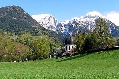
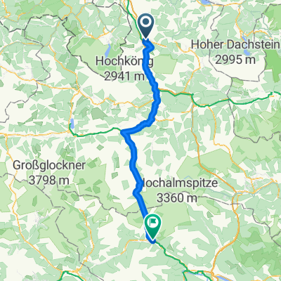
Golling-Annaberg-Abtenau
A cycling route starting in Golling an der Salzach, Salzburg, Austria.
Overview
About this route
Golling-PassLueg-Annaberg-Abtenau ca. 75 km
- -:--
- Duration
- 76.3 km
- Distance
- 696 m
- Ascent
- 720 m
- Descent
- ---
- Avg. speed
- ---
- Max. altitude

Route quality
Waytypes & surfaces along the route
Waytypes
Quiet road
1.5 km
(2 %)
Path
1.5 km
(2 %)
Surfaces
Paved
65.6 km
(86 %)
Unpaved
0.8 km
(1 %)
Asphalt
65.6 km
(86 %)
Gravel
0.8 km
(1 %)
Undefined
9.9 km
(13 %)
Continue with Bikemap
Use, edit, or download this cycling route
You would like to ride Golling-Annaberg-Abtenau or customize it for your own trip? Here is what you can do with this Bikemap route:
Free features
- Save this route as favorite or in collections
- Copy & plan your own version of this route
- Sync your route with Garmin or Wahoo
Premium features
Free trial for 3 days, or one-time payment. More about Bikemap Premium.
- Navigate this route on iOS & Android
- Export a GPX / KML file of this route
- Create your custom printout (try it for free)
- Download this route for offline navigation
Discover more Premium features.
Get Bikemap PremiumFrom our community
Other popular routes starting in Golling an der Salzach
 2011 Golling-Schladming
- Distance
- 67.1 km
- Ascent
- 648 m
- Descent
- 403 m
- Location
- Golling an der Salzach, Salzburg, Austria
 Route Bluntautal
- Distance
- 7.9 km
- Ascent
- 183 m
- Descent
- 182 m
- Location
- Golling an der Salzach, Salzburg, Austria
 Von Golling an der Salzach bis Salzburg
- Distance
- 33.7 km
- Ascent
- 402 m
- Descent
- 451 m
- Location
- Golling an der Salzach, Salzburg, Austria
 2.7. Golling - Lofer
- Distance
- 78 km
- Ascent
- 1,703 m
- Descent
- 1,549 m
- Location
- Golling an der Salzach, Salzburg, Austria
 Baldramsdorf - Steindorf am Ossiacher See
- Distance
- 101.9 km
- Ascent
- 1,846 m
- Descent
- 1,637 m
- Location
- Golling an der Salzach, Salzburg, Austria
 Von Golling an der Salzach bis Salzburg
- Distance
- 37.1 km
- Ascent
- 399 m
- Descent
- 448 m
- Location
- Golling an der Salzach, Salzburg, Austria
 4. Golling-Siegsdorf-81km-850Hm
- Distance
- 85.4 km
- Ascent
- 1,141 m
- Descent
- 916 m
- Location
- Golling an der Salzach, Salzburg, Austria
 Mörderische Fahrt in Golling an der Salzach
- Distance
- 43.3 km
- Ascent
- 969 m
- Descent
- 969 m
- Location
- Golling an der Salzach, Salzburg, Austria
Open it in the app