

2014 Zell - Prada 6/7
A cycling route starting in Possagno, Veneto, Italy.
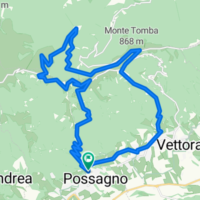
Overview
About this route
Possagno
- Forca/Grappa - Asiago - Valbona Coé- -:--
- Duration
- 163.1 km
- Distance
- 4,209 m
- Ascent
- 2,889 m
- Descent
- ---
- Avg. speed
- ---
- Max. altitude

Route quality
Waytypes & surfaces along the route
Waytypes
Road
24.5 km
(15 %)
Quiet road
14.7 km
(9 %)
Surfaces
Paved
148.4 km
(91 %)
Asphalt
148.4 km
(91 %)
Undefined
14.7 km
(9 %)
Continue with Bikemap
Use, edit, or download this cycling route
You would like to ride 2014 Zell - Prada 6/7 or customize it for your own trip? Here is what you can do with this Bikemap route:
Free features
- Save this route as favorite or in collections
- Copy & plan your own version of this route
- Split it into stages to create a multi-day tour
- Sync your route with Garmin or Wahoo
Premium features
Free trial for 3 days, or one-time payment. More about Bikemap Premium.
- Navigate this route on iOS & Android
- Export a GPX / KML file of this route
- Create your custom printout (try it for free)
- Download this route for offline navigation
Discover more Premium features.
Get Bikemap PremiumFrom our community
Other popular routes starting in Possagno
 Monte Grappa 4
- Distance
- 46.7 km
- Ascent
- 1,809 m
- Descent
- 1,811 m
- Location
- Possagno, Veneto, Italy
 La pedemontana gravel del Canova
- Distance
- 63.7 km
- Ascent
- 1,447 m
- Descent
- 1,449 m
- Location
- Possagno, Veneto, Italy
 Il Grappa con Le Meatte da Possagno
- Distance
- 39.8 km
- Ascent
- 1,640 m
- Descent
- 1,625 m
- Location
- Possagno, Veneto, Italy
 Palon,Monte Tomba,Il Canova
- Distance
- 36.8 km
- Ascent
- 1,372 m
- Descent
- 1,378 m
- Location
- Possagno, Veneto, Italy
 monte tomba super
- Distance
- 22.1 km
- Ascent
- 1,082 m
- Descent
- 1,088 m
- Location
- Possagno, Veneto, Italy
 notturna monte tomba
- Distance
- 20.8 km
- Ascent
- 1,001 m
- Descent
- 1,002 m
- Location
- Possagno, Veneto, Italy
 POSSAGNO
- Distance
- 28.8 km
- Ascent
- 1,276 m
- Descent
- 1,275 m
- Location
- Possagno, Veneto, Italy
 I_Possagno_Castel-Cesil_Weg213_16km_840hm
- Distance
- 16 km
- Ascent
- 873 m
- Descent
- 860 m
- Location
- Possagno, Veneto, Italy
Open it in the app