

KALIFORNIE 8.7.13 - Modesto - Turlock Lake camp
A cycling route starting in Empire, California, United States.
Overview
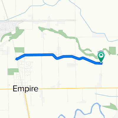
About this route
From the Bart station in Modesto along Yosemite Blvd. to Turlock Lake camp
- -:--
- Duration
- 59.1 km
- Distance
- 121 m
- Ascent
- 115 m
- Descent
- ---
- Avg. speed
- ---
- Max. altitude
Continue with Bikemap
Use, edit, or download this cycling route
You would like to ride KALIFORNIE 8.7.13 - Modesto - Turlock Lake camp or customize it for your own trip? Here is what you can do with this Bikemap route:
Free features
- Save this route as favorite or in collections
- Copy & plan your own version of this route
- Sync your route with Garmin or Wahoo
Premium features
Free trial for 3 days, or one-time payment. More about Bikemap Premium.
- Navigate this route on iOS & Android
- Export a GPX / KML file of this route
- Create your custom printout (try it for free)
- Download this route for offline navigation
Discover more Premium features.
Get Bikemap PremiumFrom our community
Other popular routes starting in Empire
 Steady ride in Modesto
- Distance
- 9.3 km
- Ascent
- 19 m
- Descent
- 18 m
- Location
- Empire, California, United States
 Sonoma Avenue 1012, Modesto to Blue Gum Avenue 2201, Modesto
- Distance
- 11.1 km
- Ascent
- 15 m
- Descent
- 23 m
- Location
- Empire, California, United States
 Quick ride through Modesto
- Distance
- 2.9 km
- Ascent
- 12 m
- Descent
- 13 m
- Location
- Empire, California, United States
 2601 Crested Bobwhite St, Modesto to 1120 Doker Dr, Modesto
- Distance
- 13 km
- Ascent
- 55 m
- Descent
- 62 m
- Location
- Empire, California, United States
 To Oakdale thru Waterford
- Distance
- 106.9 km
- Ascent
- 147 m
- Descent
- 146 m
- Location
- Empire, California, United States
 Monday morning work
- Distance
- 11.3 km
- Ascent
- 8 m
- Descent
- 12 m
- Location
- Empire, California, United States
 Slow ride in Modesto
- Distance
- 6.2 km
- Ascent
- 28 m
- Descent
- 27 m
- Location
- Empire, California, United States
 794–798 Goodwin Rd, Modesto a 794–798 Goodwin Rd, Modesto
- Distance
- 8.5 km
- Ascent
- 3 m
- Descent
- 6 m
- Location
- Empire, California, United States
Open it in the app