

Tuja Grenzland Marathon 160 km
A cycling route starting in Muldenhammer, Saxony, Germany.
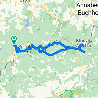
Overview
About this route
Schön wars!
- -:--
- Duration
- 159.7 km
- Distance
- 1,726 m
- Ascent
- 1,728 m
- Descent
- ---
- Avg. speed
- ---
- Max. altitude

Route quality
Waytypes & surfaces along the route
Waytypes
Busy road
102.5 km
(64 %)
Road
35.4 km
(22 %)
Surfaces
Paved
93 km
(58 %)
Unpaved
0 km
(<1 %)
Asphalt
86.8 km
(54 %)
Paved (undefined)
6.2 km
(4 %)
Continue with Bikemap
Use, edit, or download this cycling route
You would like to ride Tuja Grenzland Marathon 160 km or customize it for your own trip? Here is what you can do with this Bikemap route:
Free features
- Save this route as favorite or in collections
- Copy & plan your own version of this route
- Split it into stages to create a multi-day tour
- Sync your route with Garmin or Wahoo
Premium features
Free trial for 3 days, or one-time payment. More about Bikemap Premium.
- Navigate this route on iOS & Android
- Export a GPX / KML file of this route
- Create your custom printout (try it for free)
- Download this route for offline navigation
Discover more Premium features.
Get Bikemap PremiumFrom our community
Other popular routes starting in Muldenhammer
 Gottesberg-Keilberg-Fichtelberg-Johanngeorgenstadt-Gottesberg
- Distance
- 101.5 km
- Ascent
- 1,240 m
- Descent
- 1,240 m
- Location
- Muldenhammer, Saxony, Germany
 GRM2014_120
- Distance
- 128.5 km
- Ascent
- 1,392 m
- Descent
- 1,394 m
- Location
- Muldenhammer, Saxony, Germany
 GRM85_2013
- Distance
- 90.3 km
- Ascent
- 793 m
- Descent
- 793 m
- Location
- Muldenhammer, Saxony, Germany
 GRM2015_160 Jean
- Distance
- 157.5 km
- Ascent
- 1,635 m
- Descent
- 1,637 m
- Location
- Muldenhammer, Saxony, Germany
 Erzgebirgsrunde
- Distance
- 108.4 km
- Ascent
- 2,308 m
- Descent
- 2,314 m
- Location
- Muldenhammer, Saxony, Germany
 Heimatrunde
- Distance
- 22.4 km
- Ascent
- 376 m
- Descent
- 376 m
- Location
- Muldenhammer, Saxony, Germany
 Carlsfelder Straße 18, Muldenhammer nach Am Rosinenberg 24, Auerbach/Vogtland
- Distance
- 13.4 km
- Ascent
- 282 m
- Descent
- 403 m
- Location
- Muldenhammer, Saxony, Germany
 GRM2014_85
- Distance
- 84 km
- Ascent
- 779 m
- Descent
- 781 m
- Location
- Muldenhammer, Saxony, Germany
Open it in the app