

Mutěnické vinohrady
A cycling route starting in Mutěnice, South Moravian, Czechia.
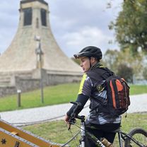
Overview
About this route
The route partly follows the path of the popular March through the vineyards of Slovácko. This year we won't be able to participate in the march, so we want to remember it at least this way. And maybe we’ll even have a glass of the delicious local nectar along the way :-).
- -:--
- Duration
- 40 km
- Distance
- 364 m
- Ascent
- 364 m
- Descent
- ---
- Avg. speed
- ---
- Max. altitude

Route quality
Waytypes & surfaces along the route
Waytypes
Track
19.2 km
(48 %)
Road
6.4 km
(16 %)
Surfaces
Paved
12 km
(30 %)
Unpaved
16.8 km
(42 %)
Asphalt
8.4 km
(21 %)
Unpaved (undefined)
8 km
(20 %)
Continue with Bikemap
Use, edit, or download this cycling route
You would like to ride Mutěnické vinohrady or customize it for your own trip? Here is what you can do with this Bikemap route:
Free features
- Save this route as favorite or in collections
- Copy & plan your own version of this route
- Sync your route with Garmin or Wahoo
Premium features
Free trial for 3 days, or one-time payment. More about Bikemap Premium.
- Navigate this route on iOS & Android
- Export a GPX / KML file of this route
- Create your custom printout (try it for free)
- Download this route for offline navigation
Discover more Premium features.
Get Bikemap PremiumFrom our community
Other popular routes starting in Mutěnice
 SKLEP 2009 III
- Distance
- 164.6 km
- Ascent
- 653 m
- Descent
- 585 m
- Location
- Mutěnice, South Moravian, Czechia
 Mutěnice_Břeclav
- Distance
- 41.7 km
- Ascent
- 122 m
- Descent
- 143 m
- Location
- Mutěnice, South Moravian, Czechia
 IX.20.7.Streda-Mutěnice-(Hodonin)-Uherske H. pres Kostelany-Kroměříž
- Distance
- 96.5 km
- Ascent
- 482 m
- Descent
- 476 m
- Location
- Mutěnice, South Moravian, Czechia
 Mutěnice do boby
- Distance
- 62 km
- Ascent
- 920 m
- Descent
- 936 m
- Location
- Mutěnice, South Moravian, Czechia
 Okolo Mutěnic
- Distance
- 60.3 km
- Ascent
- 447 m
- Descent
- 451 m
- Location
- Mutěnice, South Moravian, Czechia
 Mikulov
- Distance
- 101 km
- Ascent
- 604 m
- Descent
- 606 m
- Location
- Mutěnice, South Moravian, Czechia
 Mutěnice okruh 13. 9. 2015
- Distance
- 57.9 km
- Ascent
- 305 m
- Descent
- 302 m
- Location
- Mutěnice, South Moravian, Czechia
 Buchlov
- Distance
- 91.1 km
- Ascent
- 666 m
- Descent
- 667 m
- Location
- Mutěnice, South Moravian, Czechia
Open it in the app