

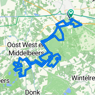
Rondje De Kempen (zo)
A cycling route starting in Oirschot, North Brabant, The Netherlands.
Overview
About this route
via Luyksgestel and the agricultural area "De Pielis" on Sunday, August 25, 2013. T.C de Pedaleur Oirschot, 62 participants.
- -:--
- Duration
- 72.1 km
- Distance
- 50 m
- Ascent
- 49 m
- Descent
- ---
- Avg. speed
- ---
- Max. altitude
Route quality
Waytypes & surfaces along the route
Waytypes
Quiet road
33.2 km
(46 %)
Cycleway
28.8 km
(40 %)
Surfaces
Paved
22.3 km
(31 %)
Unpaved
2.9 km
(4 %)
Asphalt
19.5 km
(27 %)
Concrete
2.9 km
(4 %)
Continue with Bikemap
Use, edit, or download this cycling route
You would like to ride Rondje De Kempen (zo) or customize it for your own trip? Here is what you can do with this Bikemap route:
Free features
- Save this route as favorite or in collections
- Copy & plan your own version of this route
- Sync your route with Garmin or Wahoo
Premium features
Free trial for 3 days, or one-time payment. More about Bikemap Premium.
- Navigate this route on iOS & Android
- Export a GPX / KML file of this route
- Create your custom printout (try it for free)
- Download this route for offline navigation
Discover more Premium features.
Get Bikemap PremiumFrom our community
Other popular routes starting in Oirschot
 14 mei 2015 (do) Oirschot-Ravenstein v.v.
- Distance
- 134.7 km
- Ascent
- 37 m
- Descent
- 37 m
- Location
- Oirschot, North Brabant, The Netherlands
 Rondje De Kempen (zo)
- Distance
- 72.1 km
- Ascent
- 50 m
- Descent
- 49 m
- Location
- Oirschot, North Brabant, The Netherlands
 16-11-2018 (vr) Rondje Lieshout
- Distance
- 47.9 km
- Ascent
- 30 m
- Descent
- 30 m
- Location
- Oirschot, North Brabant, The Netherlands
 23-10-2015 Rondje Kampina (vr)
- Distance
- 24.2 km
- Ascent
- 35 m
- Descent
- 35 m
- Location
- Oirschot, North Brabant, The Netherlands
 7-7-2019 (zo) Land van Maas/Waal/Linge + land van Altena
- Distance
- 152 km
- Ascent
- 26 m
- Descent
- 26 m
- Location
- Oirschot, North Brabant, The Netherlands
 Rondje Drunen
- Distance
- 73.2 km
- Ascent
- 22 m
- Descent
- 22 m
- Location
- Oirschot, North Brabant, The Netherlands
 OIRSCHOT
- Distance
- 38.2 km
- Ascent
- 46 m
- Descent
- 49 m
- Location
- Oirschot, North Brabant, The Netherlands
 18/9/14 (Do) Laatste donderdagavond tocht 2014
- Distance
- 41.2 km
- Ascent
- 41 m
- Descent
- 41 m
- Location
- Oirschot, North Brabant, The Netherlands
Open it in the app