

Alpencross 2013 - Tag 2 - 03.09.2013
A cycling route starting in Klösterle, Vorarlberg, Austria.
Overview
About this route
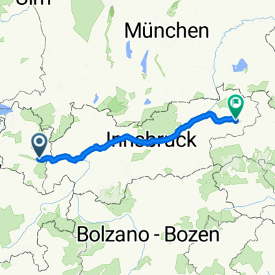
From Wald am Arlberg (approx. 1,000m) we start at 09:30 right away with a 10km ascent to Sonnenkopf (1,835m) with an average grade of 10%. Heading towards Silbertal and Heilbronner Hütte, we ride through Wasserstubental and find ourselves in Verwall. Up to the Oberen Freschalpe (1,890m), we can ride well on gravel. From there, it's only possible to push; for at least 3km we stumble through Silbertal over stones, through streams, and almost slip in mud mixed with cow dung. At Langer See, I have to tend to a blister on my left heel. A band-aid on that and onward we go. Over the Silbertaler Winterjöchle (1,945m) we arrive at Schönverwalltal. For just under 2km, we can ride again, up to Schönverwallhütte (2,007m). There, Steffen provides first aid to a girl from Vienna of Czech descent who has twisted her ankle. We accompany her all the way to Heilbronner Hütte. And again we push. After 1km and after the Rosanna bridge, it becomes really steep. For 1.5 km we push and pull our bikes over large natural steps that have been washed out by meltwater. Just before the Scheidseen, we eventually ride on a nice trail again. There is no time for a rest at Heilbronner Hütte since we lost about 1.5 hours due to the injured girl. It is only around 18:00 that we are below the hut (2,277m). There is no time for a snack because we still have 1.5 hours of descent down to Ischgl ahead. On wide paths, we race downhill. In the rush of speed, we miss a turn and have to accept a few extra altitude meters back to Zeinisee. On asphalt, we zip quickly through Galtür to Ischgl, where after 10 hours, Gabi waits eagerly for us at 19:30. René is totally hypoglycemic, so Gabi and I get pizza for dinner at Hotel Neder.
- -:--
- Duration
- 64.7 km
- Distance
- 2,082 m
- Ascent
- 1,766 m
- Descent
- ---
- Avg. speed
- ---
- Max. altitude

Continue with Bikemap
Use, edit, or download this cycling route
You would like to ride Alpencross 2013 - Tag 2 - 03.09.2013 or customize it for your own trip? Here is what you can do with this Bikemap route:
Free features
- Save this route as favorite or in collections
- Copy & plan your own version of this route
- Sync your route with Garmin or Wahoo
Premium features
Free trial for 3 days, or one-time payment. More about Bikemap Premium.
- Navigate this route on iOS & Android
- Export a GPX / KML file of this route
- Create your custom printout (try it for free)
- Download this route for offline navigation
Discover more Premium features.
Get Bikemap PremiumFrom our community
Other popular routes starting in Klösterle
 Cyklodovolená 2017 3.den
- Distance
- 82.1 km
- Ascent
- 437 m
- Descent
- 985 m
- Location
- Klösterle, Vorarlberg, Austria
 Alpencross 2013 - Tag 2 - 03.09.2013
- Distance
- 64.7 km
- Ascent
- 2,082 m
- Descent
- 1,766 m
- Location
- Klösterle, Vorarlberg, Austria
 Wald am Arlberg 133 nach Langen am Arlberg 28, Klösterle
- Distance
- 7.5 km
- Ascent
- 0 m
- Descent
- 576 m
- Location
- Klösterle, Vorarlberg, Austria
 CICLO 2015 - 1a TAPPA
- Distance
- 91.1 km
- Ascent
- 39 m
- Descent
- 857 m
- Location
- Klösterle, Vorarlberg, Austria
 Tour - túra 12.
- Distance
- 215 km
- Ascent
- 1,221 m
- Descent
- 1,475 m
- Location
- Klösterle, Vorarlberg, Austria
 Tag 2 - St. Anton Gaispitzstürmer
- Distance
- 59 km
- Ascent
- 1,879 m
- Descent
- 2,472 m
- Location
- Klösterle, Vorarlberg, Austria
 Arlberg Piller-Höhe Hahntennjoch Flexen
- Distance
- 149 km
- Ascent
- 4,457 m
- Descent
- 4,459 m
- Location
- Klösterle, Vorarlberg, Austria
 TransAlp: Fischen - Gardasee Tag 2
- Distance
- 52.4 km
- Ascent
- 1,333 m
- Descent
- 1,361 m
- Location
- Klösterle, Vorarlberg, Austria
Open it in the app