

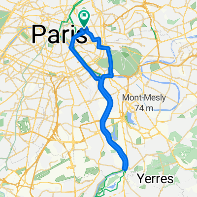
Marnes et Ourq
A cycling route starting in Bagnolet, Île-de-France Region, France.
Overview
About this route
Cyclable, à vérifier en réel
- -:--
- Duration
- 103.3 km
- Distance
- 202 m
- Ascent
- 202 m
- Descent
- ---
- Avg. speed
- ---
- Max. altitude
Route quality
Waytypes & surfaces along the route
Waytypes
Cycleway
21.6 km
(21 %)
Quiet road
20.3 km
(20 %)
Surfaces
Paved
57.7 km
(56 %)
Unpaved
11.9 km
(11 %)
Asphalt
56.4 km
(55 %)
Gravel
9.5 km
(9 %)
Continue with Bikemap
Use, edit, or download this cycling route
You would like to ride Marnes et Ourq or customize it for your own trip? Here is what you can do with this Bikemap route:
Free features
- Save this route as favorite or in collections
- Copy & plan your own version of this route
- Split it into stages to create a multi-day tour
- Sync your route with Garmin or Wahoo
Premium features
Free trial for 3 days, or one-time payment. More about Bikemap Premium.
- Navigate this route on iOS & Android
- Export a GPX / KML file of this route
- Create your custom printout (try it for free)
- Download this route for offline navigation
Discover more Premium features.
Get Bikemap PremiumFrom our community
Other popular routes starting in Bagnolet
 De 53 Rue Planchat, Paris à 8 Grande Rue de Vaux, Berneuil-en-Bray
- Distance
- 94.2 km
- Ascent
- 837 m
- Descent
- 768 m
- Location
- Bagnolet, Île-de-France Region, France
 bord de seine vers villeneuve le roi
- Distance
- 38.4 km
- Ascent
- 74 m
- Descent
- 74 m
- Location
- Bagnolet, Île-de-France Region, France
 2011-01 2work
- Distance
- 9.4 km
- Ascent
- 67 m
- Descent
- 97 m
- Location
- Bagnolet, Île-de-France Region, France
 De Lefevre - Surmelin, Paris à Voie Voie Provisoire BW/17 14, Paris
- Distance
- 9 km
- Ascent
- 34 m
- Descent
- 99 m
- Location
- Bagnolet, Île-de-France Region, France
 Les coteaux et la véloscénie
- Distance
- 39 km
- Ascent
- 246 m
- Descent
- 247 m
- Location
- Bagnolet, Île-de-France Region, France
 Grande boucle VTT à faire
- Distance
- 73.3 km
- Ascent
- 193 m
- Descent
- 193 m
- Location
- Bagnolet, Île-de-France Region, France
 Etapa 023C (París - Bresles)
- Distance
- 124.2 km
- Ascent
- 785 m
- Descent
- 809 m
- Location
- Bagnolet, Île-de-France Region, France
 Paris - Tours
- Distance
- 241.3 km
- Ascent
- 319 m
- Descent
- 334 m
- Location
- Bagnolet, Île-de-France Region, France
Open it in the app