

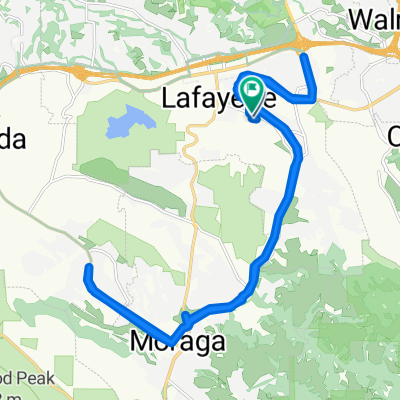
Happy Valley to Grizzly Peak
A cycling route starting in Lafayette, California, United States.
Overview
About this route
Hope it's not too foggy!
- -:--
- Duration
- 39.1 km
- Distance
- 903 m
- Ascent
- 903 m
- Descent
- ---
- Avg. speed
- ---
- Max. altitude

Route quality
Waytypes & surfaces along the route
Waytypes
Road
31.7 km
(81 %)
Quiet road
2.3 km
(6 %)
Surfaces
Paved
29.3 km
(75 %)
Asphalt
25 km
(64 %)
Paved (undefined)
4.3 km
(11 %)
Undefined
9.8 km
(25 %)
Continue with Bikemap
Use, edit, or download this cycling route
You would like to ride Happy Valley to Grizzly Peak or customize it for your own trip? Here is what you can do with this Bikemap route:
Free features
- Save this route as favorite or in collections
- Copy & plan your own version of this route
- Sync your route with Garmin or Wahoo
Premium features
Free trial for 3 days, or one-time payment. More about Bikemap Premium.
- Navigate this route on iOS & Android
- Export a GPX / KML file of this route
- Create your custom printout (try it for free)
- Download this route for offline navigation
Discover more Premium features.
Get Bikemap PremiumFrom our community
Other popular routes starting in Lafayette
 Bay ride
- Distance
- 197.4 km
- Ascent
- 1,822 m
- Descent
- 1,823 m
- Location
- Lafayette, California, United States
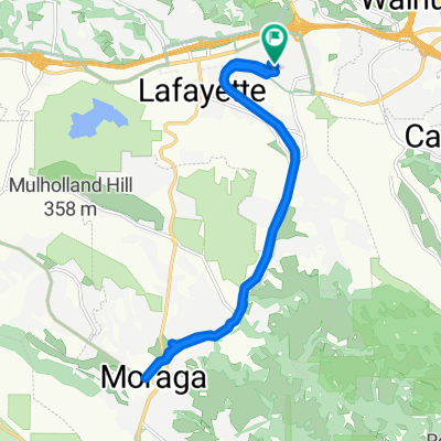
 Lafayette - Mt. Diablo - Pleasant Hill
- Distance
- 63.7 km
- Ascent
- 1,530 m
- Descent
- 1,572 m
- Location
- Lafayette, California, United States
 3758 Mount Diablo Blvd, Lafayette to 3925–3963 Mount Diablo Blvd, Lafayette
- Distance
- 19.3 km
- Ascent
- 17 m
- Descent
- 21 m
- Location
- Lafayette, California, United States
 Campolinda Route
- Distance
- 56.3 km
- Ascent
- 558 m
- Descent
- 557 m
- Location
- Lafayette, California, United States
 820 Skywood Rd, Lafayette to 3425 Saint Mary's Rd, Lafayette
- Distance
- 29.9 km
- Ascent
- 85 m
- Descent
- 106 m
- Location
- Lafayette, California, United States
 Lamoraga Redwood loop
- Distance
- 29.5 km
- Ascent
- 305 m
- Descent
- 305 m
- Location
- Lafayette, California, United States
 Part 1 Crockett Ride
- Distance
- 28.2 km
- Ascent
- 418 m
- Descent
- 419 m
- Location
- Lafayette, California, United States
 Friday Ride In Lafayette
- Distance
- 19.3 km
- Ascent
- 177 m
- Descent
- 174 m
- Location
- Lafayette, California, United States
Open it in the app