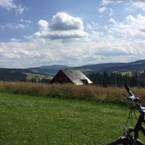
istebna jaworzynka
A cycling route starting in Istebna, Silesian Voivodeship, Poland.
Overview
About this route
Start z z parkingu poniżej kościółka na Górce w Istebne. Wjazd na górkę przy kościele i zjazd w dół, przejazd przez wszsytkie smiesznie nazwane wsie tj. Dragony i odbicie w prawo bardzo ostrym podjazdem, następnie delikatnie w dół, troche połogo i znów ostro w dół serpentynami po asfalcie aż do wypłaszczenia w okolicach trójstyku. Ostatni podjazd pod trójstyk i stamtąd w linii prostej jak pokazuje ślad.<br /> <br /> Nie zaznaczyłem odbica w prawo o którym wspomniałem, ponieważ nie jestem w stanie dokładnie sprecyzować miejsca gdzie się odbijało z głównej drogi<br /> <br /> <br /> Trasa w rzeczywistości jest 2x dłuższa niż wynika z przebiegu trasy, ponieważ nie potrafie ustawić powrotu tą samą drogą
- -:--
- Duration
- 5.5 km
- Distance
- 173 m
- Ascent
- 144 m
- Descent
- ---
- Avg. speed
- ---
- Max. altitude
Route quality
Waytypes & surfaces along the route
Waytypes
Road
3.5 km
(63 %)
Busy road
1.2 km
(21 %)
Surfaces
Paved
5.1 km
(93 %)
Asphalt
5.1 km
(92 %)
Paving stones
0 km
(<1 %)
Undefined
0.4 km
(7 %)
Continue with Bikemap
Use, edit, or download this cycling route
You would like to ride istebna jaworzynka or customize it for your own trip? Here is what you can do with this Bikemap route:
Free features
- Save this route as favorite or in collections
- Copy & plan your own version of this route
- Sync your route with Garmin or Wahoo
Premium features
Free trial for 3 days, or one-time payment. More about Bikemap Premium.
- Navigate this route on iOS & Android
- Export a GPX / KML file of this route
- Create your custom printout (try it for free)
- Download this route for offline navigation
Discover more Premium features.
Get Bikemap PremiumFrom our community
Other popular routes starting in Istebna
 Planowana wisłostrada
- Distance
- 598.8 km
- Ascent
- 758 m
- Descent
- 963 m
- Location
- Istebna, Silesian Voivodeship, Poland
 7VII`13 VELKY POLOM + KAMESZNICA/Szare/Zameczek/Milosova
- Distance
- 106.6 km
- Ascent
- 1,615 m
- Descent
- 1,625 m
- Location
- Istebna, Silesian Voivodeship, Poland
 Beskidy "W poszukiwaniu Zoncolan"
- Distance
- 110.7 km
- Ascent
- 1,830 m
- Descent
- 1,817 m
- Location
- Istebna, Silesian Voivodeship, Poland
 Salmopol Barania
- Distance
- 40.8 km
- Ascent
- 1,109 m
- Descent
- 1,108 m
- Location
- Istebna, Silesian Voivodeship, Poland
 Trawers dookoła Baraniej Góry z Kubalonki
- Distance
- 30.8 km
- Ascent
- 997 m
- Descent
- 801 m
- Location
- Istebna, Silesian Voivodeship, Poland
 Kubalonka
- Distance
- 21.6 km
- Ascent
- 618 m
- Descent
- 618 m
- Location
- Istebna, Silesian Voivodeship, Poland
 ride through Andziołówka
- Distance
- 19.3 km
- Ascent
- 386 m
- Descent
- 386 m
- Location
- Istebna, Silesian Voivodeship, Poland
 WTR Wisła - Oświęcim
- Distance
- 98.9 km
- Ascent
- 53 m
- Descent
- 366 m
- Location
- Istebna, Silesian Voivodeship, Poland
Open it in the app

