Inauguracja sezonu 2026r
- 27.3 km
- 215 m
- 230 m
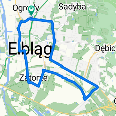
- Elblag, Warmian-Masurian Voivodeship, Poland
A cycling route starting in Elblag, Warmian-Masurian Voivodeship, Poland.
Overview
Route: Elbląg, Helenowo, Wikrowo, Jegłownik, Gronowo Elbląskie, Różany, Kępniewo, Stare Dolno, Powodowo, Wysoka, Topolno Wielkie, Jelonki, Krosno, Drużno, Dłużyna, Węzina, komorowo Żuławskie, Gronowo Górne, Elbląg
created this 12 years ago
Route quality
Road
33.7 km
54 %
Quiet road
18.1 km
29 %
Paved
23.1 km
(37 %)
Asphalt
23.1 km
37 %
Undefined
39.4 km
63 %
Continue with Bikemap
You would like to ride Wycieczka Nr 28/2013 – Dookoła jeziora Drużno - 22 września or customize it for your own trip? Here is what you can do with this Bikemap route:
Free trial for 3 days, or one-time payment. More about Bikemap Premium.
Discover more Premium features.
Get Bikemap PremiumFrom our community
Open it in the app