

Kazimierski Park Krajobrazowy
A cycling route starting in Wąwolnica, Lublin Voivodeship, Poland.
Overview
About this route
Route in Wąwolnica near Nałęczów, passing through Kazimierz nad Wisłą to the Firlej Castle in Janowiec nad Wisłą. Simple, but requires some effort as it runs through the hills and ravines of the Puławy county.
We start from Wąwolnica – the starting place is a square serving as the market. There you will find a map with marked trails (including ours). We head towards Stanisławka (passing the Wąwolnica cemetery located on a hill) and enter the first forest track. It is paved with cobblestones, so it's a pleasant ride, yet... it is an uphill section, so some effort is necessary. The ravine characteristic for the Kazimierz area provides excellent shade from excessive sun. In autumn it must look breathtaking – when the leaves start painting the golden colors of this season (unfortunately, I was there in spring).
The route alternates between gravel and asphalt as we head to Kazimierz. There we find a bike path running along the Vistula River and ride to the ferry crossing. Practically from April to November (depending on the water level in the Vistula) you can cross to Janowiec. Firlej Castle is visible from the ferry, but it makes the biggest impression from the village at its foot.
The climb onto the castle hill is a bit steep, and unfortunately along a road paved with field stones – for those not seasoned in cycling, it is quite a challenge. But it is a short section – you can walk the bike if necessary.
The castle is open for visits, next to it there is a picnic and rest area, although I wouldn't count on buying something substantial to eat.
Return by the same route to the ferry, after crossing—back to Kazimierz Dolny. From the market square, head towards Doły / Wylągi. Asphalt road, climbs of 10 - 12%. We reach Skrowieszynek – there we cross road no. 824 and continue on a dirt path to Rzeczyca. From there we continue the journey to Rąblów, the road turns back to asphalt and that’s how we return to Wąwolnica.
- -:--
- Duration
- 44.9 km
- Distance
- 292 m
- Ascent
- 292 m
- Descent
- ---
- Avg. speed
- ---
- Max. altitude

Continue with Bikemap
Use, edit, or download this cycling route
You would like to ride Kazimierski Park Krajobrazowy or customize it for your own trip? Here is what you can do with this Bikemap route:
Free features
- Save this route as favorite or in collections
- Copy & plan your own version of this route
- Sync your route with Garmin or Wahoo
Premium features
Free trial for 3 days, or one-time payment. More about Bikemap Premium.
- Navigate this route on iOS & Android
- Export a GPX / KML file of this route
- Create your custom printout (try it for free)
- Download this route for offline navigation
Discover more Premium features.
Get Bikemap PremiumFrom our community
Other popular routes starting in Wąwolnica
 Celejow-Deblin-Pulawy-Celejow 90km
- Distance
- 90.5 km
- Ascent
- 188 m
- Descent
- 188 m
- Location
- Wąwolnica, Lublin Voivodeship, Poland
 to naleczow
- Distance
- 13.6 km
- Ascent
- 156 m
- Descent
- 163 m
- Location
- Wąwolnica, Lublin Voivodeship, Poland
 Wąwolnica - Nałęczów - Wąwolnica
- Distance
- 13.4 km
- Ascent
- 87 m
- Descent
- 87 m
- Location
- Wąwolnica, Lublin Voivodeship, Poland
 Celejow-Naleczow-Kazimierz-Janowiec-Celejow 75km
- Distance
- 73.9 km
- Ascent
- 477 m
- Descent
- 477 m
- Location
- Wąwolnica, Lublin Voivodeship, Poland
 Steady ride in Wąwolnica
- Distance
- 20 km
- Ascent
- 167 m
- Descent
- 166 m
- Location
- Wąwolnica, Lublin Voivodeship, Poland
 Wąwozy kazimierskie
- Distance
- 47.5 km
- Ascent
- 412 m
- Descent
- 415 m
- Location
- Wąwolnica, Lublin Voivodeship, Poland
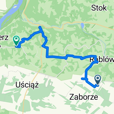 Zaborze do Romualda Traugutta 26, Lublin
- Distance
- 17.1 km
- Ascent
- 136 m
- Descent
- 173 m
- Location
- Wąwolnica, Lublin Voivodeship, Poland
 Kazimierski Park Krajobrazowy
- Distance
- 44.9 km
- Ascent
- 297 m
- Descent
- 297 m
- Location
- Wąwolnica, Lublin Voivodeship, Poland
Open it in the app