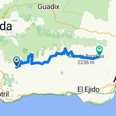
Por la alpujarra
A cycling route starting in Soportújar, Andalusia, Spain.
Overview
About this route
Ruta por sierra nevada
- -:--
- Duration
- 17.3 km
- Distance
- 1,350 m
- Ascent
- 61 m
- Descent
- ---
- Avg. speed
- ---
- Max. altitude
Route quality
Waytypes & surfaces along the route
Waytypes
Track
14.9 km
(86 %)
Quiet road
2.4 km
(14 %)
Surfaces
Paved
2.4 km
(14 %)
Unpaved
2.9 km
(17 %)
Gravel
2.9 km
(17 %)
Paved (undefined)
2.4 km
(14 %)
Undefined
11.9 km
(69 %)
Continue with Bikemap
Use, edit, or download this cycling route
You would like to ride Por la alpujarra or customize it for your own trip? Here is what you can do with this Bikemap route:
Free features
- Save this route as favorite or in collections
- Copy & plan your own version of this route
- Sync your route with Garmin or Wahoo
Premium features
Free trial for 3 days, or one-time payment. More about Bikemap Premium.
- Navigate this route on iOS & Android
- Export a GPX / KML file of this route
- Create your custom printout (try it for free)
- Download this route for offline navigation
Discover more Premium features.
Get Bikemap PremiumFrom our community
Other popular routes starting in Soportújar
Ermita del Padre Eterno-Puente Palo-Mirador de Cáñar- Río Lanjarón- Distance
- 37.6 km
- Ascent
- 975 m
- Descent
- 982 m
- Location
- Soportújar, Andalusia, Spain
Por la alpujarra- Distance
- 17.3 km
- Ascent
- 1,350 m
- Descent
- 61 m
- Location
- Soportújar, Andalusia, Spain
Ermita del Padre Eterno - Puentepalo- Distance
- 10.8 km
- Ascent
- 932 m
- Descent
- 106 m
- Location
- Soportújar, Andalusia, Spain
Soportujar Sendero- Distance
- 1.4 km
- Ascent
- 189 m
- Descent
- 86 m
- Location
- Soportújar, Andalusia, Spain
Transnevada- Distance
- 458.7 km
- Ascent
- 5,458 m
- Descent
- 5,467 m
- Location
- Soportújar, Andalusia, Spain
Ermita Fte. Agrilla - O Sei Ling- Distance
- 6.2 km
- Ascent
- 818 m
- Descent
- 178 m
- Location
- Soportújar, Andalusia, Spain
Ermita Padre Eterno - O Sei Ling- Distance
- 6.5 km
- Ascent
- 832 m
- Descent
- 166 m
- Location
- Soportújar, Andalusia, Spain
Soportújar - Canjáyar- Distance
- 94.5 km
- Ascent
- 989 m
- Descent
- 831 m
- Location
- Soportújar, Andalusia, Spain
Open it in the app

