

III ETAPA Sarajevo-Olovo-Kladanj-Vlasenica-Milići-Bratunac-Potočari(Srebrenica)
A cycling route starting in Kobilja Glava, Federation of Bosnia and Herzegovina, Bosnia and Herzegovina.
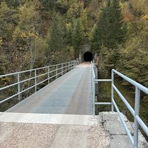
Overview
About this route
III ETAPA
Najzahtjevnija ruta što se tiče uzbrdica!
- -:--
- Duration
- 161 km
- Distance
- 2,475 m
- Ascent
- 2,655 m
- Descent
- ---
- Avg. speed
- 1,037 m
- Max. altitude

Route quality
Waytypes & surfaces along the route
Waytypes
Quiet road
29 km
(18 %)
Access road
3.2 km
(2 %)
Surfaces
Paved
117.6 km
(73 %)
Asphalt
117.6 km
(73 %)
Undefined
43.5 km
(27 %)
Route highlights
Points of interest along the route
Point of interest after 135.2 km
Konjevića Polje
Point of interest after 157.4 km
Bratunac
Point of interest after 161 km
CILJ:POTOČARI
Continue with Bikemap
Use, edit, or download this cycling route
You would like to ride III ETAPA Sarajevo-Olovo-Kladanj-Vlasenica-Milići-Bratunac-Potočari(Srebrenica) or customize it for your own trip? Here is what you can do with this Bikemap route:
Free features
- Save this route as favorite or in collections
- Copy & plan your own version of this route
- Split it into stages to create a multi-day tour
- Sync your route with Garmin or Wahoo
Premium features
Free trial for 3 days, or one-time payment. More about Bikemap Premium.
- Navigate this route on iOS & Android
- Export a GPX / KML file of this route
- Create your custom printout (try it for free)
- Download this route for offline navigation
Discover more Premium features.
Get Bikemap PremiumFrom our community
Other popular routes starting in Kobilja Glava
 Museum-Dariva-Zamjevac-Barica-Cavljak-City
- Distance
- 26.5 km
- Ascent
- 693 m
- Descent
- 690 m
- Location
- Kobilja Glava, Federation of Bosnia and Herzegovina, Bosnia and Herzegovina
 Bistrik-Vogošća-Blažuj-Hrasnica-Bistrik
- Distance
- 54.3 km
- Ascent
- 471 m
- Descent
- 470 m
- Location
- Kobilja Glava, Federation of Bosnia and Herzegovina, Bosnia and Herzegovina
 Dariva, Sarajevo to Dariva, Sarajevo
- Distance
- 37.8 km
- Ascent
- 990 m
- Descent
- 1,017 m
- Location
- Kobilja Glava, Federation of Bosnia and Herzegovina, Bosnia and Herzegovina
 Ruta Smrti
- Distance
- 26.4 km
- Ascent
- 960 m
- Descent
- 1,062 m
- Location
- Kobilja Glava, Federation of Bosnia and Herzegovina, Bosnia and Herzegovina
 Сарајево - Θεσσαλονίκη
- Distance
- 914.1 km
- Ascent
- 6,076 m
- Descent
- 6,593 m
- Location
- Kobilja Glava, Federation of Bosnia and Herzegovina, Bosnia and Herzegovina
 Močila, Sarajevo to Put za Skakavac, Sarajevo
- Distance
- 15.2 km
- Ascent
- 852 m
- Descent
- 346 m
- Location
- Kobilja Glava, Federation of Bosnia and Herzegovina, Bosnia and Herzegovina
 Nevjestina, Sarajevo to Dariva, Sarajevo
- Distance
- 24.9 km
- Ascent
- 439 m
- Descent
- 452 m
- Location
- Kobilja Glava, Federation of Bosnia and Herzegovina, Bosnia and Herzegovina
 Trebevic Jahorina
- Distance
- 48.4 km
- Ascent
- 1,353 m
- Descent
- 1,353 m
- Location
- Kobilja Glava, Federation of Bosnia and Herzegovina, Bosnia and Herzegovina
Open it in the app