

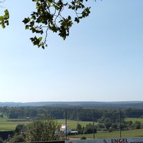
Simmozheim
A cycling route starting in Simmozheim, Baden-Württemberg, Germany.
Overview
About this route
relativ einfach zu fahrende Strecke - am Anfang kleiner Berg (gut zu meistern) zum Schluss in Simmozheim kernige Steigung auf den Gaisberg hoch.
- -:--
- Duration
- 16.3 km
- Distance
- 260 m
- Ascent
- 250 m
- Descent
- ---
- Avg. speed
- 573 m
- Max. altitude
Route quality
Waytypes & surfaces along the route
Waytypes
Busy road
9.4 km
(58 %)
Road
5.1 km
(31 %)
Surfaces
Paved
16.3 km
(100 %)
Asphalt
16.3 km
(100 %)
Continue with Bikemap
Use, edit, or download this cycling route
You would like to ride Simmozheim or customize it for your own trip? Here is what you can do with this Bikemap route:
Free features
- Save this route as favorite or in collections
- Copy & plan your own version of this route
- Sync your route with Garmin or Wahoo
Premium features
Free trial for 3 days, or one-time payment. More about Bikemap Premium.
- Navigate this route on iOS & Android
- Export a GPX / KML file of this route
- Create your custom printout (try it for free)
- Download this route for offline navigation
Discover more Premium features.
Get Bikemap PremiumFrom our community
Other popular routes starting in Simmozheim
 Aufnahme vom 5. Januar, 9:30
- Distance
- 42.5 km
- Ascent
- 355 m
- Descent
- 345 m
- Location
- Simmozheim, Baden-Württemberg, Germany
 Simmozheim-Schellbronn
- Distance
- 25.1 km
- Ascent
- 228 m
- Descent
- 226 m
- Location
- Simmozheim, Baden-Württemberg, Germany
 Simmozheim
- Distance
- 16.3 km
- Ascent
- 260 m
- Descent
- 250 m
- Location
- Simmozheim, Baden-Württemberg, Germany
 3 TAELERTOUR
- Distance
- 37.6 km
- Ascent
- 708 m
- Descent
- 709 m
- Location
- Simmozheim, Baden-Württemberg, Germany
 Nagold / Monbachtalrunde
- Distance
- 32.1 km
- Ascent
- 453 m
- Descent
- 451 m
- Location
- Simmozheim, Baden-Württemberg, Germany
 Mötzingen - Kirchheim Teck
- Distance
- 75.8 km
- Ascent
- 561 m
- Descent
- 805 m
- Location
- Simmozheim, Baden-Württemberg, Germany
 Simmozheim Donaueschingen
- Distance
- 149 km
- Ascent
- 1,612 m
- Descent
- 1,313 m
- Location
- Simmozheim, Baden-Württemberg, Germany
 Münklingen Unterreichenbach
- Distance
- 31.3 km
- Ascent
- 389 m
- Descent
- 386 m
- Location
- Simmozheim, Baden-Württemberg, Germany
Open it in the app