

Alpes-Autumn-CC -- Trieben - Linz 142km REC-Stage
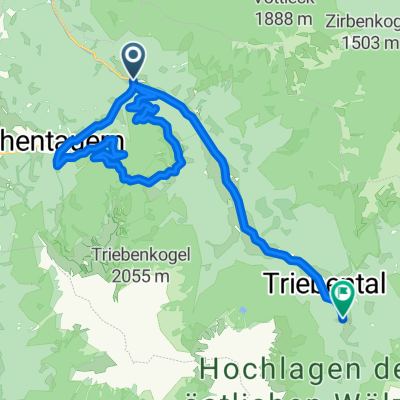
A cycling route starting in Hohentauern, Styria, Austria.
Overview
About this route
stretch / shake / relax Tour after Super-Stage
- -:--
- Duration
- 152.9 km
- Distance
- 465 m
- Ascent
- 1,394 m
- Descent
- ---
- Avg. speed
- ---
- Max. altitude

Route quality
Waytypes & surfaces along the route
Waytypes
Quiet road
16.8 km
(11 %)
Cycleway
6.1 km
(4 %)
Surfaces
Paved
129.9 km
(85 %)
Unpaved
1.5 km
(1 %)
Asphalt
128.4 km
(84 %)
Paved (undefined)
1.5 km
(1 %)
Continue with Bikemap
Use, edit, or download this cycling route
You would like to ride Alpes-Autumn-CC -- Trieben - Linz 142km REC-Stage or customize it for your own trip? Here is what you can do with this Bikemap route:
Free features
- Save this route as favorite or in collections
- Copy & plan your own version of this route
- Split it into stages to create a multi-day tour
- Sync your route with Garmin or Wahoo
Premium features
Free trial for 3 days, or one-time payment. More about Bikemap Premium.
- Navigate this route on iOS & Android
- Export a GPX / KML file of this route
- Create your custom printout (try it for free)
- Download this route for offline navigation
Discover more Premium features.
Get Bikemap PremiumFrom our community
Other popular routes starting in Hohentauern
 Hohentauern 168 do Hohentauern 168
- Distance
- 13.8 km
- Ascent
- 281 m
- Descent
- 296 m
- Location
- Hohentauern, Styria, Austria
 le😃 fel
- Distance
- 11.8 km
- Ascent
- 1,759 m
- Descent
- 1,767 m
- Location
- Hohentauern, Styria, Austria
 Alpes-Autumn-CC -- Trieben - Linz 142km REC-Stage
- Distance
- 152.9 km
- Ascent
- 465 m
- Descent
- 1,394 m
- Location
- Hohentauern, Styria, Austria
 2025_Hohentauern
- Distance
- 23.7 km
- Ascent
- 1,629 m
- Descent
- 1,235 m
- Location
- Hohentauern, Styria, Austria
 Hohentauern - LZL
- Distance
- 135.6 km
- Ascent
- 1,718 m
- Descent
- 1,894 m
- Location
- Hohentauern, Styria, Austria
 2025_Hasensattelrunde
- Distance
- 20.3 km
- Ascent
- 1,339 m
- Descent
- 1,158 m
- Location
- Hohentauern, Styria, Austria
 Brodjäger Weg nach Bergmanngasse 6, Trieben
- Distance
- 4.9 km
- Ascent
- 8 m
- Descent
- 208 m
- Location
- Hohentauern, Styria, Austria
 Dorfstraße 1A, Hohentauern nach Kärntner Straße 3, Scheifling
- Distance
- 50.9 km
- Ascent
- 1,099 m
- Descent
- 1,617 m
- Location
- Hohentauern, Styria, Austria
Open it in the app