

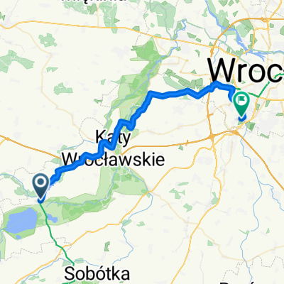
Pętla Kąty Wrocławskie - Sobótka - Tąpadła - Pożarzysko - Kąty Wrocławskie
A cycling route starting in Kąty Wrocławskie, Lower Silesian Voivodeship, Poland.
Overview
About this route
szosowaszosa.blogspot.com
- -:--
- Duration
- 87.8 km
- Distance
- 319 m
- Ascent
- 320 m
- Descent
- ---
- Avg. speed
- ---
- Max. altitude

Route quality
Waytypes & surfaces along the route
Waytypes
Road
70.2 km
(80 %)
Cycleway
2.6 km
(3 %)
Surfaces
Paved
50.9 km
(58 %)
Asphalt
50.9 km
(58 %)
Undefined
36.9 km
(42 %)
Route highlights
Points of interest along the route
Point of interest after 2.7 km
Mauzoleum marszałka Gebharda Leberechta Blüchera
Point of interest after 14.5 km
Zła jakość asfaltu - początek Poor tarmac quality - start
Point of interest after 20.3 km
Zła jakość asfaltu - koniec
Point of interest after 25 km
Caffee Break :>
Point of interest after 36.3 km
Najtrudniejsza część podjazdu
Point of interest after 39 km
Najpiękniejszy widok na Zachód
Point of interest after 49.5 km
Zła jakość asfaltu - początek
Point of interest after 51.8 km
Zła jakość asfaltu - koniec
Point of interest after 60.9 km
caffee break :>
Point of interest after 62.9 km
Żwir na szybkim zakręcie Gravel on a high speed corner
Continue with Bikemap
Use, edit, or download this cycling route
You would like to ride Pętla Kąty Wrocławskie - Sobótka - Tąpadła - Pożarzysko - Kąty Wrocławskie or customize it for your own trip? Here is what you can do with this Bikemap route:
Free features
- Save this route as favorite or in collections
- Copy & plan your own version of this route
- Split it into stages to create a multi-day tour
- Sync your route with Garmin or Wahoo
Premium features
Free trial for 3 days, or one-time payment. More about Bikemap Premium.
- Navigate this route on iOS & Android
- Export a GPX / KML file of this route
- Create your custom printout (try it for free)
- Download this route for offline navigation
Discover more Premium features.
Get Bikemap PremiumFrom our community
Other popular routes starting in Kąty Wrocławskie
 Kąty - Świdnica - Kąty - Świdnica
- Distance
- 53.9 km
- Ascent
- 633 m
- Descent
- 525 m
- Location
- Kąty Wrocławskie, Lower Silesian Voivodeship, Poland
 Dolina Bystrzycy
- Distance
- 45.5 km
- Ascent
- 80 m
- Descent
- 80 m
- Location
- Kąty Wrocławskie, Lower Silesian Voivodeship, Poland
 Wyjazd dla prawdziwych mężczyzn - dzień 1
- Distance
- 62.3 km
- Ascent
- 881 m
- Descent
- 436 m
- Location
- Kąty Wrocławskie, Lower Silesian Voivodeship, Poland
 CX Kąty - Las Ratyński - Kąty
- Distance
- 61.6 km
- Ascent
- 102 m
- Descent
- 108 m
- Location
- Kąty Wrocławskie, Lower Silesian Voivodeship, Poland
 Kąty - Płonica R9
- Distance
- 95.8 km
- Ascent
- 609 m
- Descent
- 498 m
- Location
- Kąty Wrocławskie, Lower Silesian Voivodeship, Poland
 Sobótka 2
- Distance
- 104.7 km
- Ascent
- 569 m
- Descent
- 566 m
- Location
- Kąty Wrocławskie, Lower Silesian Voivodeship, Poland
 Pętla Kąty Wrocławskie - Sobótka - Tąpadła - Pożarzysko - Kąty Wrocławskie
- Distance
- 87.8 km
- Ascent
- 319 m
- Descent
- 320 m
- Location
- Kąty Wrocławskie, Lower Silesian Voivodeship, Poland
 Mietków-Klecina
- Distance
- 38.5 km
- Ascent
- 130 m
- Descent
- 163 m
- Location
- Kąty Wrocławskie, Lower Silesian Voivodeship, Poland
Open it in the app