

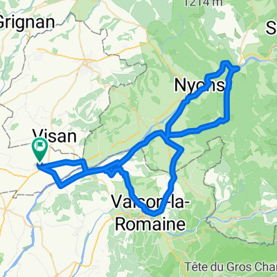
st roman - cairanne - rasteau
A cycling route starting in Tulette, Auvergne-Rhône-Alpes, France.
Overview
About this route
st roman - cairanne - rasteau
18km- -:--
- Duration
- 18.2 km
- Distance
- 352 m
- Ascent
- 352 m
- Descent
- ---
- Avg. speed
- ---
- Max. altitude

Route quality
Waytypes & surfaces along the route
Waytypes
Road
10.7 km
(59 %)
Quiet road
7.3 km
(40 %)
Undefined
0.2 km
(1 %)
Surfaces
Paved
7.8 km
(43 %)
Asphalt
7.8 km
(43 %)
Undefined
10.4 km
(57 %)
Continue with Bikemap
Use, edit, or download this cycling route
You would like to ride st roman - cairanne - rasteau or customize it for your own trip? Here is what you can do with this Bikemap route:
Free features
- Save this route as favorite or in collections
- Copy & plan your own version of this route
- Sync your route with Garmin or Wahoo
Premium features
Free trial for 3 days, or one-time payment. More about Bikemap Premium.
- Navigate this route on iOS & Android
- Export a GPX / KML file of this route
- Create your custom printout (try it for free)
- Download this route for offline navigation
Discover more Premium features.
Get Bikemap PremiumFrom our community
Other popular routes starting in Tulette
 tulette par cairanne gigondas sablet faucon mirabel tulette
- Distance
- 77.9 km
- Ascent
- 888 m
- Descent
- 853 m
- Location
- Tulette, Auvergne-Rhône-Alpes, France
 De Route de Cairanne 2125, Saint-Roman-de-Malegarde à Place de la Mairie 1, Aurel
- Distance
- 73.2 km
- Ascent
- 1,069 m
- Descent
- 439 m
- Location
- Tulette, Auvergne-Rhône-Alpes, France
 rondje tulette rasteau, sasteau, rasix, seguret en vaison
- Distance
- 49.5 km
- Ascent
- 620 m
- Descent
- 605 m
- Location
- Tulette, Auvergne-Rhône-Alpes, France
 Tour par tulette vaison chateauneuf de bordette tulette
- Distance
- 71.8 km
- Ascent
- 943 m
- Descent
- 878 m
- Location
- Tulette, Auvergne-Rhône-Alpes, France
 Tricastin
- Distance
- 37.3 km
- Ascent
- 195 m
- Descent
- 195 m
- Location
- Tulette, Auvergne-Rhône-Alpes, France
 st roman - cairanne - rasteau
- Distance
- 18.2 km
- Ascent
- 352 m
- Descent
- 352 m
- Location
- Tulette, Auvergne-Rhône-Alpes, France
 De 437 Route de Valréas, Tulette à 437 Route de Valréas, Tulette
- Distance
- 61.3 km
- Ascent
- 962 m
- Descent
- 785 m
- Location
- Tulette, Auvergne-Rhône-Alpes, France
 Rondje Seringnan-Grillon 72km
- Distance
- 71.8 km
- Ascent
- 185 m
- Descent
- 184 m
- Location
- Tulette, Auvergne-Rhône-Alpes, France
Open it in the app