

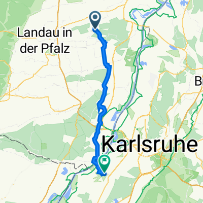
Zeiskam nach Landau: An den Bahnschienen entlang
A cycling route starting in Zeiskam, Rhineland-Palatinate, Germany.
Overview
About this route
Einfach zu fahrende Strecke von Zeiskam an der Draisinestrecke entlang nach Landau in die Innenstadt.
Ab Bornheim ist die Strecke größtenteils in der Sonne.
- -:--
- Duration
- 12 km
- Distance
- 27 m
- Ascent
- 4 m
- Descent
- ---
- Avg. speed
- 144 m
- Max. altitude
Route quality
Waytypes & surfaces along the route
Waytypes
Track
5.5 km
(46 %)
Quiet road
5.5 km
(46 %)
Surfaces
Paved
9.8 km
(82 %)
Unpaved
2 km
(16 %)
Asphalt
7.1 km
(60 %)
Paved (undefined)
2.4 km
(20 %)
Route highlights
Points of interest along the route
Point of interest after 10.2 km
Burger King - Toiletten, Getränke zum selber auffüllen
Continue with Bikemap
Use, edit, or download this cycling route
You would like to ride Zeiskam nach Landau: An den Bahnschienen entlang or customize it for your own trip? Here is what you can do with this Bikemap route:
Free features
- Save this route as favorite or in collections
- Copy & plan your own version of this route
- Sync your route with Garmin or Wahoo
Premium features
Free trial for 3 days, or one-time payment. More about Bikemap Premium.
- Navigate this route on iOS & Android
- Export a GPX / KML file of this route
- Create your custom printout (try it for free)
- Download this route for offline navigation
Discover more Premium features.
Get Bikemap PremiumFrom our community
Other popular routes starting in Zeiskam
 Zeiskam nach Landau: An den Bahnschienen entlang CLONED FROM ROUTE 234469
- Distance
- 12 km
- Ascent
- 50 m
- Descent
- 25 m
- Location
- Zeiskam, Rhineland-Palatinate, Germany
 Zeiskam - Herxheim und zurück
- Distance
- 25.2 km
- Ascent
- 104 m
- Descent
- 97 m
- Location
- Zeiskam, Rhineland-Palatinate, Germany
 Im Böbig 21/2, Zeiskam nach L510 76, Heuchelheim-Klingen
- Distance
- 27 km
- Ascent
- 109 m
- Descent
- 69 m
- Location
- Zeiskam, Rhineland-Palatinate, Germany
 Jahnstraße 16, Zeiskam nach Hauptstraße 93, Hochstadt (Pfalz)
- Distance
- 3.4 km
- Ascent
- 17 m
- Descent
- 4 m
- Location
- Zeiskam, Rhineland-Palatinate, Germany
 Hauptstraße 87, Zeiskam nach Wilhelm-Röntgen-Straße 15, Rheinstetten
- Distance
- 37.9 km
- Ascent
- 39 m
- Descent
- 53 m
- Location
- Zeiskam, Rhineland-Palatinate, Germany
 Hauptstraße 28, Zeiskam nach In den Elfmorgen, Edesheim
- Distance
- 12.1 km
- Ascent
- 64 m
- Descent
- 36 m
- Location
- Zeiskam, Rhineland-Palatinate, Germany
 Runde SA morgen
- Distance
- 16.9 km
- Ascent
- 59 m
- Descent
- 56 m
- Location
- Zeiskam, Rhineland-Palatinate, Germany
 Pfälzer Wald 134 km 1750 hm
- Distance
- 133.6 km
- Ascent
- 1,453 m
- Descent
- 1,452 m
- Location
- Zeiskam, Rhineland-Palatinate, Germany
Open it in the app