
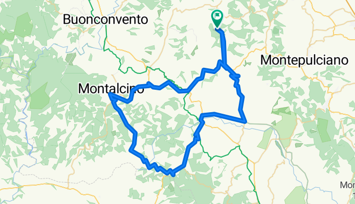
Pienza Montalcino
A cycling route starting in San Giovanni d'Asso, Tuscany, Italy.
Overview
About this route
10/3/13, 11:29 AM
- -:--
- Duration
- 79 km
- Distance
- 1,208 m
- Ascent
- 1,218 m
- Descent
- ---
- Avg. speed
- ---
- Max. altitude
Continue with Bikemap
Use, edit, or download this cycling route
You would like to ride Pienza Montalcino or customize it for your own trip? Here is what you can do with this Bikemap route:
Free features
- Save this route as favorite or in collections
- Copy & plan your own version of this route
- Sync your route with Garmin or Wahoo
Premium features
Free trial for 3 days, or one-time payment. More about Bikemap Premium.
- Navigate this route on iOS & Android
- Export a GPX / KML file of this route
- Create your custom printout (try it for free)
- Download this route for offline navigation
Discover more Premium features.
Get Bikemap PremiumFrom our community
Other popular routes starting in San Giovanni d'Asso
 Pienza Montalcino
- Distance
- 79 km
- Ascent
- 1,208 m
- Descent
- 1,218 m
- Location
- San Giovanni d'Asso, Tuscany, Italy
 64/860_Asciano_lp
- Distance
- 65.1 km
- Ascent
- 638 m
- Descent
- 636 m
- Location
- San Giovanni d'Asso, Tuscany, Italy
 2016 Certe senesi 70km
- Distance
- 69.7 km
- Ascent
- 1,056 m
- Descent
- 1,061 m
- Location
- San Giovanni d'Asso, Tuscany, Italy
 GIORNO 4
- Distance
- 48 km
- Ascent
- 493 m
- Descent
- 487 m
- Location
- San Giovanni d'Asso, Tuscany, Italy
 3 - M.te Oliveto M.re - Chianciano
- Distance
- 48.6 km
- Ascent
- 710 m
- Descent
- 533 m
- Location
- San Giovanni d'Asso, Tuscany, Italy
 The best of Siena - 3 day
- Distance
- 42.4 km
- Ascent
- 885 m
- Descent
- 739 m
- Location
- San Giovanni d'Asso, Tuscany, Italy
 GIORNO 3
- Distance
- 80.7 km
- Ascent
- 1,256 m
- Descent
- 1,258 m
- Location
- San Giovanni d'Asso, Tuscany, Italy
 Giro di Toscana 2 var (Mt. Amiata)
- Distance
- 124.3 km
- Ascent
- 2,219 m
- Descent
- 2,219 m
- Location
- San Giovanni d'Asso, Tuscany, Italy
Open it in the app