

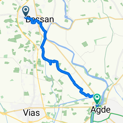
Bessan 2013
A cycling route starting in Bessan, Occitanie, France.
Overview
About this route
von Bessan über Marseilan Einfahrt Canal du Midi über Cap de Agde nach Grau de Agde Agde nach Vias Plage
- -:--
- Duration
- 45.3 km
- Distance
- 54 m
- Ascent
- 54 m
- Descent
- ---
- Avg. speed
- ---
- Max. altitude
Continue with Bikemap
Use, edit, or download this cycling route
You would like to ride Bessan 2013 or customize it for your own trip? Here is what you can do with this Bikemap route:
Free features
- Save this route as favorite or in collections
- Copy & plan your own version of this route
- Sync your route with Garmin or Wahoo
Premium features
Free trial for 3 days, or one-time payment. More about Bikemap Premium.
- Navigate this route on iOS & Android
- Export a GPX / KML file of this route
- Create your custom printout (try it for free)
- Download this route for offline navigation
Discover more Premium features.
Get Bikemap PremiumFrom our community
Other popular routes starting in Bessan
 Itinéraire vers Chemin du Théron, Vendres
- Distance
- 27.4 km
- Ascent
- 72 m
- Descent
- 44 m
- Location
- Bessan, Occitanie, France
 3bis Rue du Commerce, Bessan nach Le Pont Romain, St.-Thibéry
- Distance
- 4.9 km
- Ascent
- 0 m
- Descent
- 13 m
- Location
- Bessan, Occitanie, France
 Impasse des Tamaris, Bessan à Place Jean Jaurès, Agde
- Distance
- 9.6 km
- Ascent
- 4 m
- Descent
- 16 m
- Location
- Bessan, Occitanie, France
 Chemin de Saint-Bernard, Bessan à 1 Rue du Carignan, Florensac
- Distance
- 5.8 km
- Ascent
- 6 m
- Descent
- 3 m
- Location
- Bessan, Occitanie, France
 Bessan - Florensac
- Distance
- 6.4 km
- Ascent
- 8 m
- Descent
- 8 m
- Location
- Bessan, Occitanie, France
 De Lotissement les André 7, Bessan à Lotissement les André 6, Bessan
- Distance
- 26.2 km
- Ascent
- 162 m
- Descent
- 163 m
- Location
- Bessan, Occitanie, France
 Bessan 2013
- Distance
- 45.3 km
- Ascent
- 54 m
- Descent
- 54 m
- Location
- Bessan, Occitanie, France
Open it in the app