

Dordogne 20130716
A cycling route starting in Lagrave, Occitanie, France.
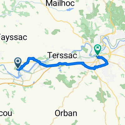
Overview
About this route
Nejkratší cestou přes pár kopečků do Roquecourbe, aby nám zbyl čas na odpolední vyjížďku do oblasti Sidobre.
- -:--
- Duration
- 50.9 km
- Distance
- 490 m
- Ascent
- 416 m
- Descent
- ---
- Avg. speed
- ---
- Max. altitude

Route quality
Waytypes & surfaces along the route
Waytypes
Road
34.1 km
(67 %)
Quiet road
4.1 km
(8 %)
Surfaces
Paved
5.1 km
(10 %)
Asphalt
5.1 km
(10 %)
Undefined
45.8 km
(90 %)
Continue with Bikemap
Use, edit, or download this cycling route
You would like to ride Dordogne 20130716 or customize it for your own trip? Here is what you can do with this Bikemap route:
Free features
- Save this route as favorite or in collections
- Copy & plan your own version of this route
- Sync your route with Garmin or Wahoo
Premium features
Free trial for 3 days, or one-time payment. More about Bikemap Premium.
- Navigate this route on iOS & Android
- Export a GPX / KML file of this route
- Create your custom printout (try it for free)
- Download this route for offline navigation
Discover more Premium features.
Get Bikemap PremiumFrom our community
Other popular routes starting in Lagrave
 Dordogne 20130715
- Distance
- 38.9 km
- Ascent
- 184 m
- Descent
- 181 m
- Location
- Lagrave, Occitanie, France
 Dordogne 20130716
- Distance
- 50.9 km
- Ascent
- 490 m
- Descent
- 416 m
- Location
- Lagrave, Occitanie, France
 Recovered Route
- Distance
- 5.3 km
- Ascent
- 21 m
- Descent
- 4 m
- Location
- Lagrave, Occitanie, France
 pprrrrrr
- Distance
- 10.4 km
- Ascent
- 75 m
- Descent
- 56 m
- Location
- Lagrave, Occitanie, France
 Allée du Beaupré, Rivières nach Rue des Pénitents, Albi
- Distance
- 21 km
- Ascent
- 101 m
- Descent
- 65 m
- Location
- Lagrave, Occitanie, France
 D 21, Rivières à D 200, Rivières
- Distance
- 20.7 km
- Ascent
- 85 m
- Descent
- 83 m
- Location
- Lagrave, Occitanie, France
 De Rue du Cerisier 8, Rivières a Rue du Cerisier 8, Rivières
- Distance
- 25.1 km
- Ascent
- 148 m
- Descent
- 149 m
- Location
- Lagrave, Occitanie, France
 FRANCIE_2015_DORDOGNE_8etapa
- Distance
- 88.8 km
- Ascent
- 1,029 m
- Descent
- 958 m
- Location
- Lagrave, Occitanie, France
Open it in the app