

Dordogne 20130718
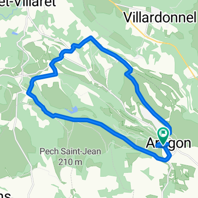
A cycling route starting in Villegailhenc, Occitanie, France.
Overview
About this route
Ranní návštěva 4 katarských hradů v Lastours. Přesun ke kanálu du Midi a podél něj do Carcasonne. Prohlídka opevněného města a zpátky podél kanálu a ještě kousek dál. Přes čerstvě vyasfaltovanou silnici do Lagrasse. <h1 style="margin: 0px 0px 15px; padding: 0px; border-top-width: 0px; border-right-width: 0px; border-left-width: 0px; border-bottom-style: none; outline: 0px; font-weight: normal; font-size: 22px; line-height: 22px; font-family: ProximaNovaSoft-Regular, Helvetica, 'Helvetica Neue', sans-serif; color: rgb(88, 173, 202);"> </h1>
- -:--
- Duration
- 73.7 km
- Distance
- 361 m
- Ascent
- 512 m
- Descent
- ---
- Avg. speed
- ---
- Max. altitude

Route quality
Waytypes & surfaces along the route
Waytypes
Road
16.2 km
(22 %)
Path
15.5 km
(21 %)
Surfaces
Paved
28.7 km
(39 %)
Unpaved
16.2 km
(22 %)
Asphalt
28.7 km
(39 %)
Gravel
5.2 km
(7 %)
Continue with Bikemap
Use, edit, or download this cycling route
You would like to ride Dordogne 20130718 or customize it for your own trip? Here is what you can do with this Bikemap route:
Free features
- Save this route as favorite or in collections
- Copy & plan your own version of this route
- Sync your route with Garmin or Wahoo
Premium features
Free trial for 3 days, or one-time payment. More about Bikemap Premium.
- Navigate this route on iOS & Android
- Export a GPX / KML file of this route
- Create your custom printout (try it for free)
- Download this route for offline navigation
Discover more Premium features.
Get Bikemap PremiumFrom our community
Other popular routes starting in Villegailhenc
 Relaxed route in Aragon
- Distance
- 17.5 km
- Ascent
- 316 m
- Descent
- 314 m
- Location
- Villegailhenc, Occitanie, France
 Aragon circuit 6
- Distance
- 33.6 km
- Ascent
- 558 m
- Descent
- 528 m
- Location
- Villegailhenc, Occitanie, France
 Pic de Nore from Aragon 2
- Distance
- 66.8 km
- Ascent
- 1,875 m
- Descent
- 1,857 m
- Location
- Villegailhenc, Occitanie, France
 1945 - 1/7
- Distance
- 159.8 km
- Ascent
- 3,245 m
- Descent
- 2,746 m
- Location
- Villegailhenc, Occitanie, France
 16 Avenue du Languedoc, Villegailhenc to 31B Rue Aimé Ramond, Carcassonne
- Distance
- 8.6 km
- Ascent
- 73 m
- Descent
- 88 m
- Location
- Villegailhenc, Occitanie, France
 Od Dordogne do Provence 9.etapa
- Distance
- 63.1 km
- Ascent
- 229 m
- Descent
- 451 m
- Location
- Villegailhenc, Occitanie, France
 De Rue de la Facture 5, Villegailhenc à Route du Pic de Nore, Pradelles-Cabardès
- Distance
- 31.6 km
- Ascent
- 1,575 m
- Descent
- 510 m
- Location
- Villegailhenc, Occitanie, France
 Pic de Nore from Aragon
- Distance
- 73.8 km
- Ascent
- 2,395 m
- Descent
- 2,376 m
- Location
- Villegailhenc, Occitanie, France
Open it in the app