

Subida al Buitre 2013
A cycling route starting in Canjáyar, Andalusia, Spain.
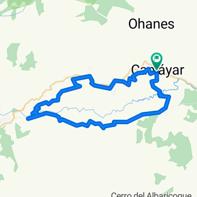
Overview
About this route
Ascent route to Pico del Buitre 2013 and subsequent meal.
- -:--
- Duration
- 70.8 km
- Distance
- 1,989 m
- Ascent
- 1,989 m
- Descent
- ---
- Avg. speed
- ---
- Max. altitude
Route quality
Waytypes & surfaces along the route
Waytypes
Track
51.7 km
(73 %)
Road
17 km
(24 %)
Undefined
2.1 km
(3 %)
Surfaces
Paved
1.4 km
(2 %)
Unpaved
24.8 km
(35 %)
Gravel
24.8 km
(35 %)
Asphalt
1.4 km
(2 %)
Undefined
44.6 km
(63 %)
Continue with Bikemap
Use, edit, or download this cycling route
You would like to ride Subida al Buitre 2013 or customize it for your own trip? Here is what you can do with this Bikemap route:
Free features
- Save this route as favorite or in collections
- Copy & plan your own version of this route
- Sync your route with Garmin or Wahoo
Premium features
Free trial for 3 days, or one-time payment. More about Bikemap Premium.
- Navigate this route on iOS & Android
- Export a GPX / KML file of this route
- Create your custom printout (try it for free)
- Download this route for offline navigation
Discover more Premium features.
Get Bikemap PremiumFrom our community
Other popular routes starting in Canjáyar
 2ª CICLOTURISTA SANTA CRUZ-CANJÁYAR
- Distance
- 61.4 km
- Ascent
- 1,454 m
- Descent
- 1,438 m
- Location
- Canjáyar, Andalusia, Spain
 ALCORA-AGUADULCE
- Distance
- 74.4 km
- Ascent
- 2,462 m
- Descent
- 2,524 m
- Location
- Canjáyar, Andalusia, Spain
 Canjayar-alcora-minas almocita-boliñeva
- Distance
- 31.5 km
- Ascent
- 736 m
- Descent
- 736 m
- Location
- Canjáyar, Andalusia, Spain
 canjayar-alcora-padules
- Distance
- 16.7 km
- Ascent
- 563 m
- Descent
- 563 m
- Location
- Canjáyar, Andalusia, Spain
 Canjayar - Padules - Almocita - Alcora
- Distance
- 35.8 km
- Ascent
- 840 m
- Descent
- 830 m
- Location
- Canjáyar, Andalusia, Spain
 canjayar hoanes piedra los angeles
- Distance
- 4.8 km
- Ascent
- 526 m
- Descent
- 182 m
- Location
- Canjáyar, Andalusia, Spain
 Subida al Buitre 2013
- Distance
- 70.8 km
- Ascent
- 1,989 m
- Descent
- 1,989 m
- Location
- Canjáyar, Andalusia, Spain
 CANJÁYAR-BUITRE y MIGAS
- Distance
- 70.4 km
- Ascent
- 1,976 m
- Descent
- 1,982 m
- Location
- Canjáyar, Andalusia, Spain
Open it in the app