

Ocolul Ciucasului
A cycling route starting in Crivina, Brașov County, Romania.
Overview
About this route
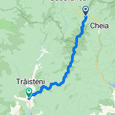
Cheia - Mogoş - Valea Stânii - Pasul Boncuţa - Heroes' Cemetery of Tabla Buţii - Pasul Boncuţa - Vama Buzăului - Dălghiu - Poiana Dălghiului - Şaua Teslei - Poiana Teslei - Babarunca Cabin - Pasul Bratocei - Cheia.
From Pasul Boncuţa, you can choose whether to visit the Heroes' Cemetery of Tabla Buţii or continue your route towards Vama Buzăului. After Poiana Dălghiului, we continue uphill towards Poiana Teslei, until its end where there is a Forestry Office house. From here follows a section where you need to push your bike through the forest; the route goes just to the left of the house and if you're attentive you'll discover a red triangle mark on the trees (this mark isn't on the map). At the ridge top, we meet tourist trail signs coming from Poiana Teslei and will have to choose whether to go left (southeast) towards Șaua Teslei and then down to a road, or right (northwest) towards the beautiful Poiana a Teslei. Then you descend towards Babarunca Cabin and from there climb up to Pasul Bratocei to finish with a nice descent ending in Cheia. The route was done in June 2009 together with George and Ciprian. It's one of the most picturesque and cleanest routes I've ridden.
- -:--
- Duration
- 77.4 km
- Distance
- 1,625 m
- Ascent
- 1,625 m
- Descent
- ---
- Avg. speed
- ---
- Max. altitude

Continue with Bikemap
Use, edit, or download this cycling route
You would like to ride Ocolul Ciucasului or customize it for your own trip? Here is what you can do with this Bikemap route:
Free features
- Save this route as favorite or in collections
- Copy & plan your own version of this route
- Sync your route with Garmin or Wahoo
Premium features
Free trial for 3 days, or one-time payment. More about Bikemap Premium.
- Navigate this route on iOS & Android
- Export a GPX / KML file of this route
- Create your custom printout (try it for free)
- Download this route for offline navigation
Discover more Premium features.
Get Bikemap PremiumFrom our community
Other popular routes starting in Crivina
 Asaltul Grohotis: din Cheia la baraj Paltinul (Valea Doftana)
- Distance
- 33.6 km
- Ascent
- 680 m
- Descent
- 1,267 m
- Location
- Crivina, Brașov County, Romania
 Ciucas - plecare de la Vama54
- Distance
- 54.9 km
- Ascent
- 1,513 m
- Descent
- 1,509 m
- Location
- Crivina, Brașov County, Romania
 Varful Ciucas prin Valea Berii
- Distance
- 5.1 km
- Ascent
- 756 m
- Descent
- 67 m
- Location
- Crivina, Brașov County, Romania
 GrohotisMnt - BratoceaPass Peak ValeaDoftanei
- Distance
- 31.8 km
- Ascent
- 663 m
- Descent
- 1,241 m
- Location
- Crivina, Brașov County, Romania
 Ocolul Ciucaşului, ediţia a II-a
- Distance
- 78.4 km
- Ascent
- 1,594 m
- Descent
- 1,594 m
- Location
- Crivina, Brașov County, Romania
 Pasul Boncuta-Maneciu
- Distance
- 46.2 km
- Ascent
- 650 m
- Descent
- 865 m
- Location
- Crivina, Brașov County, Romania
 Cheia - Muntele Rosu - Cabana Ciucas - Tigaile Mari - Ocol Vf. Zaganu prin Valea Stanii - Cheia
- Distance
- 50 km
- Ascent
- 1,218 m
- Descent
- 1,218 m
- Location
- Crivina, Brașov County, Romania
 Ciucas MTB
- Distance
- 39.4 km
- Ascent
- 801 m
- Descent
- 1,196 m
- Location
- Crivina, Brașov County, Romania
Open it in the app