- 63.2 km
- 144 m
- 144 m
- Cmolas, Subcarpathian Voivodeship, Poland
2013/8 Ostrowy Baranowskie - Babule - Durdy - Komorów Osiczyny
A cycling route starting in Cmolas, Subcarpathian Voivodeship, Poland.
Overview
About this route
Route ridden on October 11, 2013.
- -:--
- Duration
- 41 km
- Distance
- 74 m
- Ascent
- 74 m
- Descent
- ---
- Avg. speed
- ---
- Max. altitude
created this 12 years ago
Route quality
Waytypes & surfaces along the route
Waytypes
Track
16.8 km
(41 %)
Quiet road
11.5 km
(28 %)
Surfaces
Paved
22.6 km
(55 %)
Unpaved
15.2 km
(37 %)
Asphalt
22.6 km
(55 %)
Loose gravel
9.4 km
(23 %)
Route highlights
Points of interest along the route

Point of interest after 0.3 km
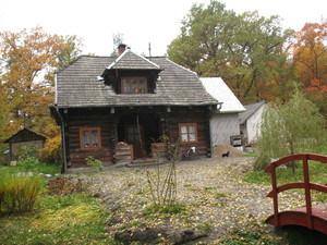
Ostrowy Baranowskie

Point of interest after 2.7 km
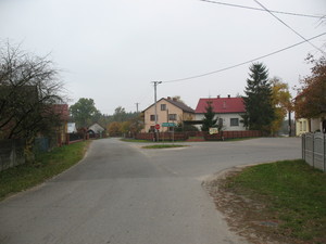
Ostrowy Baranowskie

Point of interest after 3.8 km
Ostrowy Baranowskie

Point of interest after 5.4 km
Ostrowy Baranowskie

Point of interest after 6.3 km
Ostrowy Baranowskie

Point of interest after 7.1 km
Rezerwat Pateraki

Point of interest after 7.8 km
Rezerwat Pateraki, rzeka Jamnica

Point of interest after 7.8 km
Rezerwat Pateraki

Point of interest after 7.8 km
Rezerwat Pateraki, rzeka Jamnica

Point of interest after 8.2 km
Pateraki, rzeka Jamnica

Point of interest after 8.2 km
Pateraki, most na Jamnicy

Point of interest after 8.2 km
Pateraki

Point of interest after 8.6 km
Na trasie Pateraki - Babule

Point of interest after 10.6 km
Trasa Pateraki - Babule

Point of interest after 11.8 km
Rzeka Jamnica

Point of interest after 11.8 km
Trasa Pateraki - Babule, rzeka Jamnica

Point of interest after 11.9 km
Trasa Pateraki - Babule, kapliczka przy drodze do Czajkowej

Point of interest after 13.8 km
Babule

Point of interest after 14.1 km
Babule

Point of interest after 14.2 km
Babule, rzeka Kozieniec

Point of interest after 14.8 km
Babule, przydrożna figura

Point of interest after 15.3 km
Babule

Point of interest after 15.5 km
Babule, kapliczka

Point of interest after 15.7 km
Babule, rzeka Babulówka

Point of interest after 16.2 km
Piechoty

Point of interest after 16.3 km
Piechoty

Point of interest after 17.7 km
Zachwiejów

Point of interest after 18.4 km
Zarównie

Point of interest after 18.4 km
Zarównie

Point of interest after 19.2 km
Zachwiejów

Point of interest after 19.9 km
Zachwiejów, most na Babulówce

Point of interest after 19.9 km
Rzeka Babulówka, widok w kierunku SSE

Point of interest after 19.9 km
Rzeka Babulówka, widok w kierunku NNW

Point of interest after 20.7 km
Zachwiejów (Rusinów)

Point of interest after 21.4 km
Knapy, widok w kierunku E

Point of interest after 22.5 km
Knapy

Point of interest after 22.5 km
Knapy

Point of interest after 23.9 km
Durdy, rzeka Trześniówka, widok w kierunku NE

Point of interest after 23.9 km
Durdy, rzeka Trześniówka, widok w kierunku SW

Point of interest after 24.1 km
Durdy

Point of interest after 24.5 km
Durdy, widok w kierunku E

Point of interest after 25.8 km
Durdy, widok w kierunku ESE

Point of interest after 26.3 km
Widok w kierunku E

Point of interest after 27.7 km
Widok w kierunku SE

Point of interest after 28.4 km
Wyjazd na drogę 872 Baranów Sand. - Majdan Królewski.

Point of interest after 28.6 km
Droga nr 872

Point of interest after 29.9 km
Kapliczka przydrożna na drzewie

Point of interest after 31.9 km
Przy drodze do Komorowa Osiczyn

Point of interest after 32.1 km
Miejsce piknikowe przy drodze do Komorowa Osiczyn

Point of interest after 33.3 km
W drodze do Komorowa Osiczyn, widok w kierunku W

Point of interest after 34.6 km
Rzeka Smarkatka, widok w kierunku W

Point of interest after 34.7 km
Kapliczka leśna

Point of interest after 36.7 km
Komorów Osiczyny

Point of interest after 37 km
Komorów Osiczyny

Point of interest after 40.2 km
Ostrowy Baranowskie

Point of interest after 40.5 km
Ostrowy Baranowskie

Point of interest after 40.9 km
Ostrowy Baranowskie
Continue with Bikemap
Use, edit, or download this cycling route
You would like to ride 2013/8 Ostrowy Baranowskie - Babule - Durdy - Komorów Osiczyny or customize it for your own trip? Here is what you can do with this Bikemap route:
Free features
- Save this route as favorite or in collections
- Copy & plan your own version of this route
- Sync your route with Garmin or Wahoo
Premium features
Free trial for 3 days, or one-time payment. More about Bikemap Premium.
- Navigate this route on iOS & Android
- Export a GPX / KML file of this route
- Create your custom printout (try it for free)
- Download this route for offline navigation
Discover more Premium features.
Get Bikemap PremiumFrom our community
Other popular routes starting in Cmolas
- Cmolas - Rzeszów
- Świerczów 130, Kolbuszowa do Świerczów 130, Kolbuszowa
- 24.8 km
- 190 m
- 173 m
- Cmolas, Subcarpathian Voivodeship, Poland
- Recovered Route
- 30.4 km
- 183 m
- 182 m
- Cmolas, Subcarpathian Voivodeship, Poland
- kljkljl
- 42.3 km
- 126 m
- 126 m
- Cmolas, Subcarpathian Voivodeship, Poland
- Świerczów 129, Kolbuszowa do Świerczów 130A, Kolbuszowa
- 22.8 km
- 237 m
- 235 m
- Cmolas, Subcarpathian Voivodeship, Poland
- fgdfgdfg
- 37.4 km
- 93 m
- 94 m
- Cmolas, Subcarpathian Voivodeship, Poland
- Tyczkowa
- 21.2 km
- 582 m
- 580 m
- Cmolas, Subcarpathian Voivodeship, Poland
- cmolas
- 22.7 km
- 558 m
- 551 m
- Cmolas, Subcarpathian Voivodeship, Poland
Open it in the app


