

09_RR_2014_Birmensdorf - Zürich
A cycling route starting in Birmensdorf, Canton of Zurich, Switzerland.
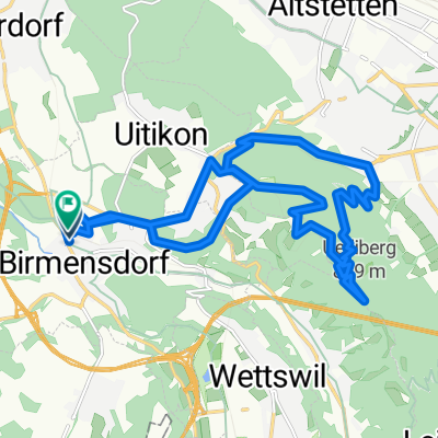
Overview
About this route
Birmensdorf - Zurich 42.88 km 460 m elevation gain
- -:--
- Duration
- 42.9 km
- Distance
- 410 m
- Ascent
- 489 m
- Descent
- ---
- Avg. speed
- ---
- Max. altitude

Route highlights
Points of interest along the route
Point of interest after 0.4 km
00km Strat 9. Etappe Birmensdorf, Bahnhof Zug S9 und S15 Bus 215 / 227 / 245 / 314
Point of interest after 7.1 km
7.00km Uitikon Waldegg, Bahnhof Zug S10 Bus 201
Point of interest after 11 km
10.90km Urdorf Weihermatt, Bahnhof Zug S9 und S15 Bus 302 und 311
Point of interest after 15.6 km
15.70km Dietikon, Bahnhof Zug S3 / S12 / S17 Bus 301 / 302 / 303 / 304 / 305 / 306 / 309 / 311
Point of interest after 21.6 km
21.80km Unterengstringen, Sennenbüel Bus 302 / 304 / 308
Point of interest after 26.7 km
26.90km Zürich, Frankental Tram 13 Bus 89 / 304 / 308
Point of interest after 31.4 km
31.30km Schlieren, Zentrum/Bahnhof Zug S3 und S12 Bus 31 / 302 / 303 / 307 / 308
Point of interest after 36.1 km
36.00km Zürich, Grünaustrasse Tram 17 Bus 78
Point of interest after 42.9 km
42.82km Ziel 9. Etappe Zürich, Sechseläutenplatz
Continue with Bikemap
Use, edit, or download this cycling route
You would like to ride 09_RR_2014_Birmensdorf - Zürich or customize it for your own trip? Here is what you can do with this Bikemap route:
Free features
- Save this route as favorite or in collections
- Copy & plan your own version of this route
- Sync your route with Garmin or Wahoo
Premium features
Free trial for 3 days, or one-time payment. More about Bikemap Premium.
- Navigate this route on iOS & Android
- Export a GPX / KML file of this route
- Create your custom printout (try it for free)
- Download this route for offline navigation
Discover more Premium features.
Get Bikemap PremiumFrom our community
Other popular routes starting in Birmensdorf
 ArbeitsRückweg
- Distance
- 25.3 km
- Ascent
- 175 m
- Descent
- 265 m
- Location
- Birmensdorf, Canton of Zurich, Switzerland
 Aesch - Affoltern - Aeugst - Türlersee - Gattikon - Birmensdorf - Aesch
- Distance
- 30.4 km
- Ascent
- 376 m
- Descent
- 376 m
- Location
- Birmensdorf, Canton of Zurich, Switzerland
 Da Eichacherstrasse 12B, Aesch ZH a Eichacherstrasse 12B, Aesch ZH
- Distance
- 50.5 km
- Ascent
- 624 m
- Descent
- 626 m
- Location
- Birmensdorf, Canton of Zurich, Switzerland
 Birmensdorf-Bonstetten
- Distance
- 6.2 km
- Ascent
- 273 m
- Descent
- 110 m
- Location
- Birmensdorf, Canton of Zurich, Switzerland
 RR_2014_Birmensdorf_9
- Distance
- 42.3 km
- Ascent
- 456 m
- Descent
- 523 m
- Location
- Birmensdorf, Canton of Zurich, Switzerland
 09_RR_2014_Birmensdorf - Zürich
- Distance
- 42.9 km
- Ascent
- 410 m
- Descent
- 489 m
- Location
- Birmensdorf, Canton of Zurich, Switzerland
 Uetliberg_bytim
- Distance
- 19.1 km
- Ascent
- 580 m
- Descent
- 568 m
- Location
- Birmensdorf, Canton of Zurich, Switzerland
 Dä Hammr
- Distance
- 27.7 km
- Ascent
- 494 m
- Descent
- 493 m
- Location
- Birmensdorf, Canton of Zurich, Switzerland
Open it in the app