

trascau
A cycling route starting in Mogoș, Alba County, Romania.
Overview
About this route
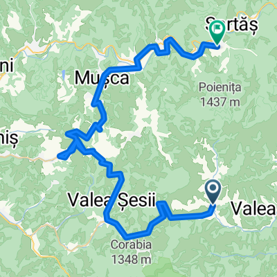
mtb rout in apuseni mountain sector trscau
- -:--
- Duration
- 115.5 km
- Distance
- 1,292 m
- Ascent
- 1,408 m
- Descent
- ---
- Avg. speed
- ---
- Max. altitude
Continue with Bikemap
Use, edit, or download this cycling route
You would like to ride trascau or customize it for your own trip? Here is what you can do with this Bikemap route:
Free features
- Save this route as favorite or in collections
- Copy & plan your own version of this route
- Split it into stages to create a multi-day tour
- Sync your route with Garmin or Wahoo
Premium features
Free trial for 3 days, or one-time payment. More about Bikemap Premium.
- Navigate this route on iOS & Android
- Export a GPX / KML file of this route
- Create your custom printout (try it for free)
- Download this route for offline navigation
Discover more Premium features.
Get Bikemap PremiumFrom our community
Other popular routes starting in Mogoș
 Mogos-Cabana Negrileasa-Sfarcea-Modolesti-Barlesti-Mogosnis
- Distance
- 50.8 km
- Ascent
- 882 m
- Descent
- 884 m
- Location
- Mogoș, Alba County, Romania
 Mogos1
- Distance
- 74.7 km
- Ascent
- 1,354 m
- Descent
- 1,353 m
- Location
- Mogoș, Alba County, Romania
 Rosia Montana - Taul Mare - Taul Corna - Taul Brazi
- Distance
- 55.6 km
- Ascent
- 1,791 m
- Descent
- 2,071 m
- Location
- Mogoș, Alba County, Romania
 Toviss
- Distance
- 284 km
- Ascent
- 1,290 m
- Descent
- 1,738 m
- Location
- Mogoș, Alba County, Romania
 Mogos-Cristesti-Valea Bucurului-Ponor-Macaresti-Mogos
- Distance
- 42.5 km
- Ascent
- 861 m
- Descent
- 859 m
- Location
- Mogoș, Alba County, Romania
 Mogos0
- Distance
- 55.3 km
- Ascent
- 1,171 m
- Descent
- 1,170 m
- Location
- Mogoș, Alba County, Romania
 ziua 2
- Distance
- 38.2 km
- Ascent
- 1,115 m
- Descent
- 1,119 m
- Location
- Mogoș, Alba County, Romania
 MOGOS2
- Distance
- 58.1 km
- Ascent
- 1,160 m
- Descent
- 1,158 m
- Location
- Mogoș, Alba County, Romania
Open it in the app